Bilzen night lights from space
Night Light of Bilzen (Flanders) from space (Belgium) Src. Average luminocity for 10x10km area is 33.2759% and for 50x50km: 33.4222%.
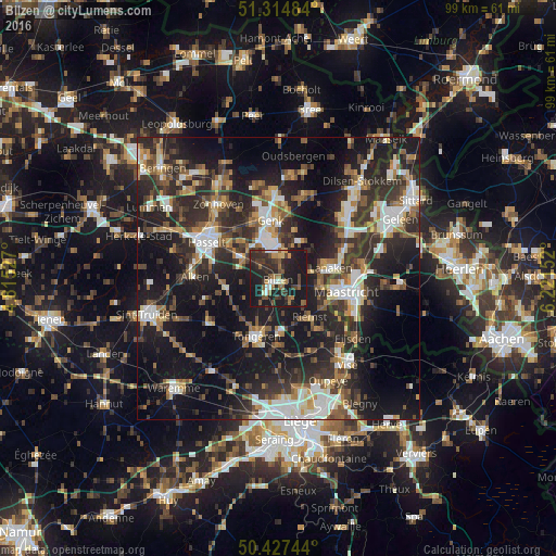
Analysis of Bilzen night lights 2016
Square area 10x10 km:
100  2.24%
2.24%
90-99 3.08%
80-89 1.82%
70-79 2.66%
60-69 6.44%
50-59 6.44%
40-49 5.88%
30-39 9.94%
20-29 19.19%
10-19 42.3%
0-9 0%
2.24%90-99
3.08%80-89
1.82%70-79
2.66%60-69
6.44%50-59
6.44%40-49
5.88%30-39
9.94%20-29
19.19%10-19
42.3%0-9
0%Square area 50x50 km:
100 4.85%
90-99 5.7%
80-89 2.41%
70-79 3.33%
60-69 4.64%
50-59 4.8%
40-49 5.63%
30-39 6.84%
20-29 14.37%
10-19 25.36%
0-9 22.07%
4.85%90-99
5.7%80-89
2.41%70-79
3.33%60-69
4.64%50-59
4.8%40-49
5.63%30-39
6.84%20-29
14.37%10-19
25.36%0-9
22.07%Clear (daylight) street map image can be seen on geolist.org.
Map coordinates:
51° 18' 53.4" North, 4° 48' 55" East
50° 52' 23.7" North, 5° 31' 6.2" East
50° 25' 38.8" North, 6° 13' 17.5" East
Some cities around Bilzen sort by population:
• Genk
10.3 km =6.4 mi,  353°
353°
• Lanaken
9.3 km =5.8 mi,  76°
76°
• Diepenbeek
8 km =5 mi,  298°
298°
• Riemst
9.1 km =5.7 mi,  140°
140°
• Hoeselt
3.6 km =2.2 mi,  216°
216°
• Kortessem
9.2 km =5.7 mi,  259°
259°
• Zutendaal
7.8 km =4.8 mi,  30°
30°
• Malberg, NL
9.6 km =6 mi,  97°
97°
2801924 (p: 29,622)
Sources (retrieved 2019-11-25):
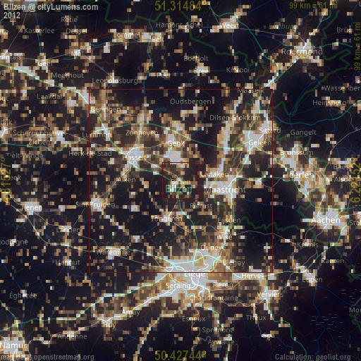
» Earth at Night: Flat Maps 2012, 2016