Tongeren night lights from space
Night Light of Tongeren (Flanders) from space (Belgium) Src. Average luminocity for 10x10km area is 28.895% and for 50x50km: 35.7988%.
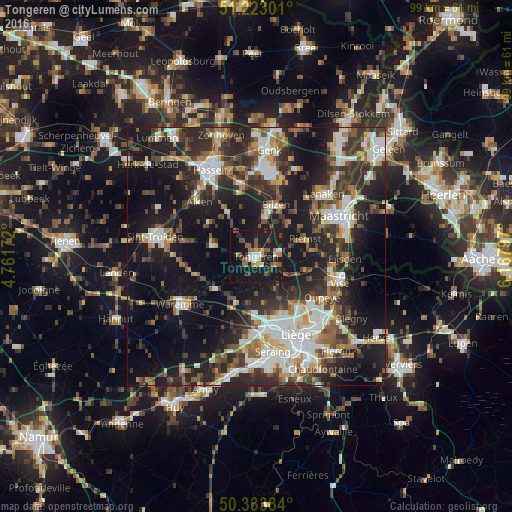
Analysis of Tongeren night lights 2016
Square area 10x10 km:
 3.22%
3.22%90-99
2.94%80-89
0.98%70-79
3.08%60-69
5.32%50-59
6.44%40-49
3.64%30-39
4.06%20-29
5.46%10-19
50.98%0-9
13.87%Square area 50x50 km:
6.04%90-99
6.93%80-89
2.79%70-79
3.29%60-69
4.57%50-59
5.01%40-49
5.62%30-39
6.93%20-29
13%10-19
24.92%0-9
20.9%Clear (daylight) street map image can be seen on geolist.org.
Map coordinates:
51° 13' 22.8" North, 4° 45' 42.2" East
50° 46' 49.9" North, 5° 27' 53.4" East
50° 20' 1.8" North, 6° 10' 4.7" East
Some cities around Tongeren sort by population:
• Bilzen
11 km =6.8 mi,  20°
20°
• Riemst
10.1 km =6.3 mi,  71°
71°
• Borgloon
8.9 km =5.5 mi,  287°
287°
• Hoeselt
7.6 km =4.7 mi,  12°
12°
• Juprelle
9.4 km =5.8 mi,  150°
150°
• Bassenge
10.5 km =6.5 mi,  103°
103°
• Kortessem
10.2 km =6.3 mi,  328°
328°
• Wellen
11.1 km =6.9 mi,  307°
307°
2785389 (p: 29,816)
Sources (retrieved 2019-11-25):
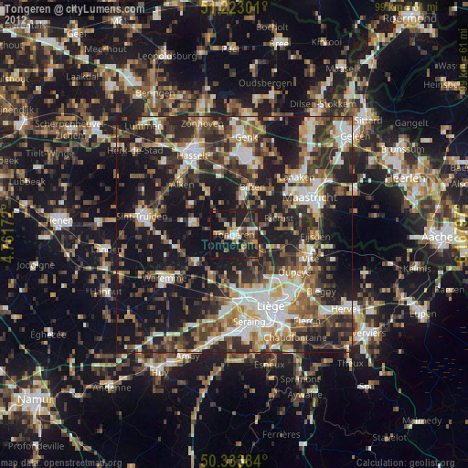
» Earth at Night: Flat Maps 2012, 2016