Herent night lights from space
Night Light of Herent (Flanders) from space (Belgium) Src. Average luminocity for 10x10km area is 65.9734% and for 50x50km: 44.456%.
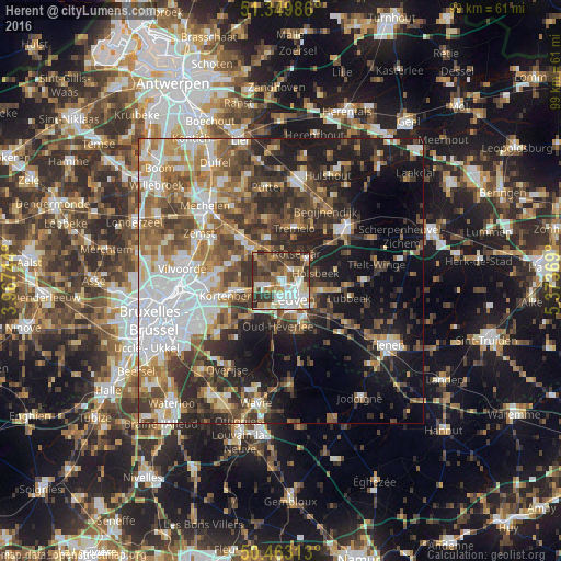
Analysis of Herent night lights 2016
Square area 10x10 km:
 15.27%
90-99
15.97%80-89
7.28%70-79
7.14%60-69
8.82%50-59
10.08%40-49
11.06%30-39
18.21%20-29
6.16%10-19
0%0-9
0%Square area 50x50 km:
10.03%90-99
7.77%80-89
3.64%70-79
5.31%60-69
6.97%50-59
7.37%40-49
7.38%30-39
8.2%20-29
10.02%10-19
14.42%0-9
18.89%Clear (daylight) street map image can be seen on geolist.org.
Map coordinates:
51° 20' 59.5" North, 3° 58' 2.8" East
50° 54' 31" North, 4° 40' 14" East
50° 27' 47.3" North, 5° 22' 25.3" East
Some cities around Herent sort by population:
• Leuven
3.9 km =2.4 mi,  146°
146°
• Kortenberg
9.1 km =5.7 mi,  256°
256°
• Rotselaar
5.9 km =3.7 mi,  33°
33°
• Haacht
8 km =5 mi,  343°
343°
• Kampenhout
9.2 km =5.7 mi,  293°
293°
• Oud-Heverlee
8.2 km =5.1 mi,  183°
183°
• Bertem
5.7 km =3.5 mi,  210°
210°
• Holsbeek
6.2 km =3.9 mi,  77°
77°
2796012 (p: 19,218)
Sources (retrieved 2019-11-25):
» Earth at Night: Flat Maps 2012, 2016