Bonheiden night lights from space
Night Light of Bonheiden (Flanders) from space (Belgium) Src. Average luminocity for 10x10km area is 63.3944% and for 50x50km: 55.8726%.
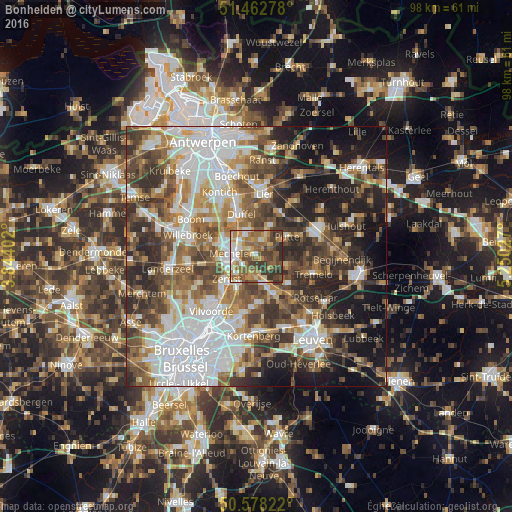
Analysis of Bonheiden night lights 2016
Square area 10x10 km:
 7.75%
7.75%90-99
10.56%80-89
7.62%70-79
12.3%60-69
14.17%50-59
18.45%40-49
13.24%30-39
11.76%20-29
4.14%10-19
0%0-9
0%Square area 50x50 km:
14.4%90-99
10.79%80-89
4.54%70-79
6.34%60-69
8.17%50-59
9.31%40-49
9.83%30-39
8.96%20-29
10.67%10-19
13.04%0-9
3.96%Clear (daylight) street map image can be seen on geolist.org.
Map coordinates:
51° 27' 46" North, 3° 50' 38.5" East
51° 1' 21.4" North, 4° 32' 49.7" East
50° 34' 41.6" North, 5° 15' 1" East
Some cities around Bonheiden sort by population:
• Mechelen
4.9 km =3 mi,  274°
274°
• Zemst
7.5 km =4.7 mi,  234°
234°
• Sint-Katelijne-Waver
5 km =3.1 mi,  349°
349°
• Duffel
8.5 km =5.3 mi,  341°
341°
• Putte
6.9 km =4.3 mi,  60°
60°
• Haacht
8.1 km =5 mi,  128°
128°
• Keerbergen
6.5 km =4 mi,  109°
109°
• Boortmeerbeek
5.2 km =3.2 mi,  158°
158°
2801539 (p: 14,260)
Sources (retrieved 2019-11-25):
» Earth at Night: Flat Maps 2012, 2016