Tremelo night lights from space
Night Light of Tremelo (Flanders) from space (Belgium) Src. Average luminocity for 10x10km area is 38.6003% and for 50x50km: 45.3793%.
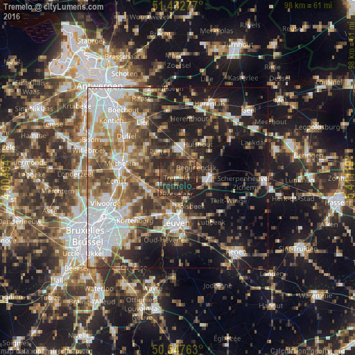
Analysis of Tremelo night lights 2016
Square area 10x10 km:
 1.07%
1.07%90-99
0.53%80-89
1.07%70-79
4.41%60-69
7.22%50-59
8.69%40-49
15.91%30-39
20.86%20-29
33.56%10-19
6.68%0-9
0%Square area 50x50 km:
10.65%90-99
8.19%80-89
3.67%70-79
5.06%60-69
6.7%50-59
7.25%40-49
7.49%30-39
7.5%20-29
9.85%10-19
18.78%0-9
14.86%Clear (daylight) street map image can be seen on geolist.org.
Map coordinates:
51° 25' 58" North, 4° 0' 17.8" East
50° 59' 32.3" North, 4° 42' 29.1" East
50° 32' 51.5" North, 5° 24' 40.3" East
Some cities around Tremelo sort by population:
• Heist-op-den-Berg
9.3 km =5.8 mi,  8°
8°
• Aarschot
9 km =5.6 mi,  93°
93°
• Putte
8.6 km =5.3 mi,  322°
322°
• Rotselaar
4.4 km =2.7 mi,  172°
172°
• Haacht
5.2 km =3.2 mi,  251°
251°
• Keerbergen
5.3 km =3.3 mi,  282°
282°
• Begijnendijk
6.1 km =3.8 mi,  60°
60°
• Holsbeek
8.7 km =5.4 mi,  156°
156°
2785293 (p: 13,721)
Sources (retrieved 2019-11-25):
» Earth at Night: Flat Maps 2012, 2016