Hastière-Lavaux night lights from space
Night Light of Hastière-Lavaux (Wallonia) from space (Belgium) Src. Average luminocity for 10x10km area is 2.2139% and for 50x50km: 7.7035%.
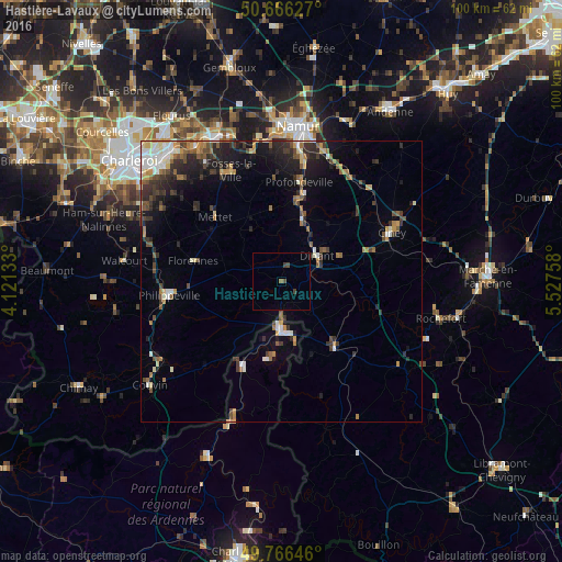
Analysis of Hastière-Lavaux night lights 2016
Square area 10x10 km:
 0%
0%90-99
0%80-89
0%70-79
0%60-69
0.27%50-59
0.27%40-49
1.6%30-39
0.53%20-29
0%10-19
0%0-9
97.33%Square area 50x50 km:
0.71%90-99
1.11%80-89
0.73%70-79
0.89%60-69
1.03%50-59
1.09%40-49
1.51%30-39
1.5%20-29
2.44%10-19
4.11%0-9
84.9%Clear (daylight) street map image can be seen on geolist.org.
Map coordinates:
50° 39' 58.6" North, 4° 7' 16.8" East
50° 13' 6.6" North, 4° 49' 28.1" East
49° 45' 59.3" North, 5° 31' 39.3" East
Some cities around Hastière-Lavaux sort by population:
• Dinant
7.6 km =4.7 mi,  54°
54°
• Mettet
16.2 km =10.1 mi,  314°
314°
• Profondeville
17.7 km =11 mi,  9°
9°
• Florennes
15.9 km =9.9 mi,  283°
283°
• Beauraing
15.2 km =9.4 mi,  142°
142°
• Yvoir
12.8 km =8 mi,  18°
18°
• Givet, FR
9 km =5.6 mi,  179°
179°
• Anhée
10.9 km =6.8 mi, 20°
2796482 (p: 5,147)
Sources (retrieved 2019-11-25):
» Earth at Night: Flat Maps 2012, 2016