Denderleeuw night lights from space
Night Light of Denderleeuw (Flanders) from space (Belgium) Src. Average luminocity for 10x10km area is 62.3389% and for 50x50km: 50.147%.
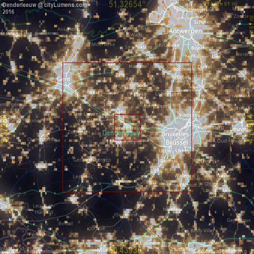
Analysis of Denderleeuw night lights 2016
Square area 10x10 km:
 5.74%
5.74%90-99
9.66%80-89
9.38%70-79
10.92%60-69
10.36%50-59
19.47%40-49
20.87%30-39
12.89%20-29
0.7%10-19
0%0-9
0%Square area 50x50 km:
9.93%90-99
8.51%80-89
4.74%70-79
5.65%60-69
7.38%50-59
9.73%40-49
10.89%30-39
10.64%20-29
13.51%10-19
10.97%0-9
8.06%Clear (daylight) street map image can be seen on geolist.org.
Map coordinates:
51° 19' 35.5" North, 3° 22' 22.4" East
50° 53' 6.2" North, 4° 4' 33.6" East
50° 26' 21.7" North, 4° 46' 44.9" East
Some cities around Denderleeuw sort by population:
• Aalst
6.3 km =3.9 mi,  333°
333°
• Ninove
7.3 km =4.5 mi,  208°
208°
• Asse
9 km =5.6 mi,  72°
72°
• Haaltert
5.8 km =3.6 mi,  294°
294°
• Ternat
6.7 km =4.2 mi,  107°
107°
• Liedekerke
2 km =1.2 mi,  155°
155°
• Gooik
10.4 km =6.5 mi,  165°
165°
• Sint-Martens-Lennik
10.5 km =6.5 mi,  141°
141°
2799647 (p: 16,969)
Sources (retrieved 2019-11-25):
» Earth at Night: Flat Maps 2012, 2016