Sint-Martens-Lennik night lights from space
Night Light of Sint-Martens-Lennik (Flanders) from space (Belgium) Src. Average luminocity for 10x10km area is 38.6176% and for 50x50km: 48.432%.
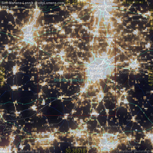
Analysis of Sint-Martens-Lennik night lights 2016
Square area 10x10 km:
 0%
0%90-99
0.84%80-89
3.78%70-79
3.64%60-69
4.76%50-59
15.13%40-49
15.97%30-39
14.15%20-29
27.31%10-19
14.43%0-9
0%Square area 50x50 km:
10.12%90-99
7.96%80-89
4.37%70-79
5.51%60-69
7.17%50-59
8.89%40-49
9.91%30-39
9.91%20-29
12.58%10-19
14.82%0-9
8.76%Clear (daylight) street map image can be seen on geolist.org.
Map coordinates:
51° 15' 13.5" North, 3° 27' 59.5" East
50° 48' 41.7" North, 4° 10' 10.7" East
50° 21' 54.6" North, 4° 52' 22" East
Some cities around Sint-Martens-Lennik sort by population:
• Dilbeek
7.5 km =4.7 mi,  57°
57°
• Ninove
10.2 km =6.3 mi,  280°
280°
• Halle
9.8 km =6.1 mi,  152°
152°
• Beersel
10.5 km =6.5 mi,  118°
118°
• Denderleeuw
10.5 km =6.5 mi,  321°
321°
• Ternat
6.1 km =3.8 mi,  358°
358°
• Liedekerke
8.6 km =5.3 mi, 317°
• Gooik
4.4 km =2.7 mi,  244°
244°
2786587 (p: 8,818)
Sources (retrieved 2019-11-25):
» Earth at Night: Flat Maps 2012, 2016