Brecht night lights from space
Night Light of Brecht (Flanders) from space (Belgium) Src. Average luminocity for 10x10km area is 20.3739% and for 50x50km: 34.9672%.
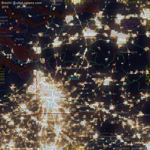
Analysis of Brecht night lights 2016
Square area 10x10 km:
 0.56%
0.56%90-99
1.4%80-89
1.12%70-79
2.24%60-69
2.94%50-59
4.2%40-49
2.94%30-39
3.22%20-29
4.62%10-19
60.78%0-9
15.97%Square area 50x50 km:
7.86%90-99
7.06%80-89
3.23%70-79
3.79%60-69
3.71%50-59
4.27%40-49
4.37%30-39
3.93%20-29
8.23%10-19
25.87%0-9
27.69%Clear (daylight) street map image can be seen on geolist.org.
Map coordinates:
51° 47' 14.2" North, 3° 56' 6.6" East
51° 21' 0.9" North, 4° 38' 17.8" East
50° 54' 32.4" North, 5° 20' 29.1" East
Some cities around Brecht sort by population:
• Brasschaat
12.1 km =7.5 mi,  237°
237°
• Zoersel
10.5 km =6.5 mi,  150°
150°
• Schilde
12.7 km =7.9 mi,  197°
197°
• Hoogstraten
10.1 km =6.3 mi,  56°
56°
• Wuustwezel
5.5 km =3.4 mi,  327°
327°
• Kalmthout
11.9 km =7.4 mi,  288°
288°
• Rijkevorsel
8.5 km =5.3 mi,  91°
91°
• Oostmalle
8.6 km =5.3 mi,  130°
130°
2801106 (p: 25,908)
Sources (retrieved 2019-11-25):
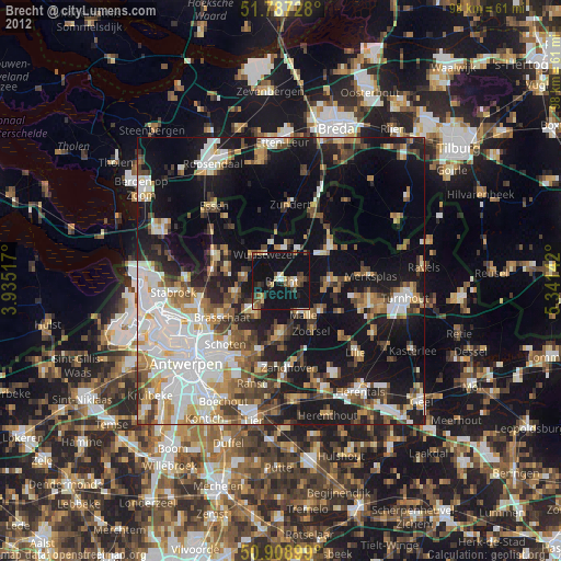
» Earth at Night: Flat Maps 2012, 2016