Brasschaat night lights from space
Night Light of Brasschaat (Flanders) from space (Belgium) Src. Average luminocity for 10x10km area is 60.2619% and for 50x50km: 40.6351%.
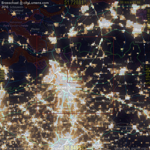
Analysis of Brasschaat night lights 2016
Square area 10x10 km:
 8.96%
8.96%90-99
10.92%80-89
12.04%70-79
9.38%60-69
7.84%50-59
11.48%40-49
11.62%30-39
7.14%20-29
16.11%10-19
4.48%0-9
0%Square area 50x50 km:
9.2%90-99
8.38%80-89
3.9%70-79
4.68%60-69
4.8%50-59
5.41%40-49
6.15%30-39
5.6%20-29
8.1%10-19
21.09%0-9
22.69%Clear (daylight) street map image can be seen on geolist.org.
Map coordinates:
51° 43' 43.7" North, 3° 47' 19.3" East
51° 17' 28.3" North, 4° 29' 30.6" East
50° 50' 57.8" North, 5° 11' 41.8" East
Some cities around Brasschaat sort by population:
• Antwerpen
10 km =6.2 mi,  217°
217°
• Deurne
8 km =5 mi,  193°
193°
• Schoten
4.4 km =2.7 mi,  170°
170°
• Kapellen
4.7 km =2.9 mi,  302°
302°
• Schilde
8.5 km =5.3 mi,  131°
131°
• Stabroek
9.5 km =5.9 mi, 298°
• Wommelgem
9.9 km =6.2 mi, 167°
• Wijnegem
7.3 km =4.5 mi,  164°
164°
2801117 (p: 37,040)
Sources (retrieved 2019-11-25):
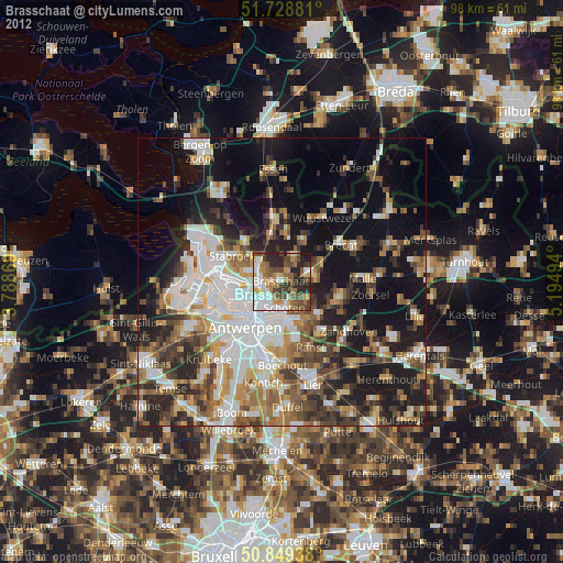
» Earth at Night: Flat Maps 2012, 2016