Rijkevorsel night lights from space
Night Light of Rijkevorsel (Flanders) from space (Belgium) Src. Average luminocity for 10x10km area is 18.0686% and for 50x50km: 28.6019%.
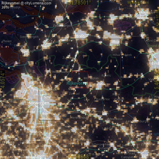
Analysis of Rijkevorsel night lights 2016
Square area 10x10 km:
 1.4%
1.4%90-99
1.68%80-89
0.7%70-79
1.82%60-69
1.4%50-59
1.4%40-49
4.06%30-39
2.24%20-29
3.22%10-19
48.18%0-9
33.89%Square area 50x50 km:
5.28%90-99
4.63%80-89
2.84%70-79
2.83%60-69
3.07%50-59
4.07%40-49
4.12%30-39
3.78%20-29
8.26%10-19
26.74%0-9
34.39%Clear (daylight) street map image can be seen on geolist.org.
Map coordinates:
51° 47' 6" North, 4° 3' 26.6" East
51° 20' 52.6" North, 4° 45' 37.9" East
50° 54' 24" North, 5° 27' 49.1" East
Some cities around Rijkevorsel sort by population:
• Brecht
8.5 km =5.3 mi,  271°
271°
• Zoersel
9.5 km =5.9 mi,  200°
200°
• Hoogstraten
5.8 km =3.6 mi,  359°
359°
• Wuustwezel
12.5 km =7.8 mi,  293°
293°
• Beerse
7.2 km =4.5 mi,  116°
116°
• Vosselaar
10 km =6.2 mi, 116°
• Merksplas
7.4 km =4.6 mi,  80°
80°
• Oostmalle
5.7 km =3.5 mi, 199°
2788051 (p: 10,606)
Sources (retrieved 2019-11-25):
» Earth at Night: Flat Maps 2012, 2016