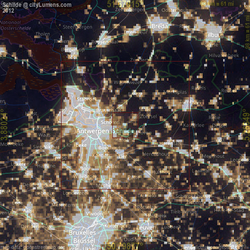
Schilde night lights from space
Night Light of Schilde (Flanders) from space (Belgium) Src. Average luminocity for 10x10km area is 48.0504% and for 50x50km: 43.3895%.
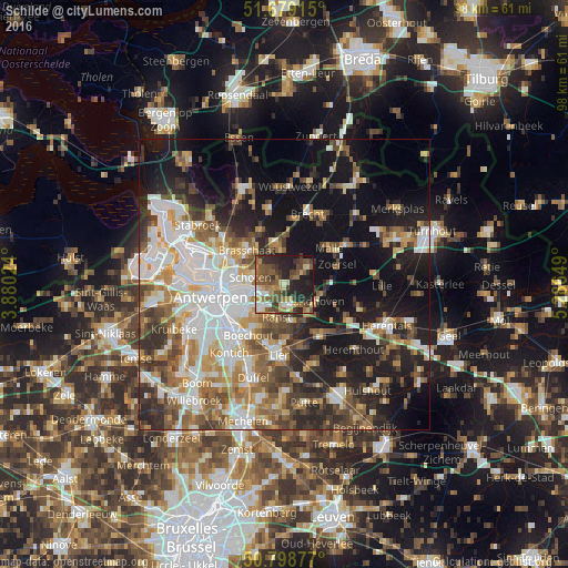
Analysis of Schilde night lights 2016
Square area 10x10 km:
 4.62%
4.62%90-99
5.32%80-89
5.6%70-79
6.86%60-69
8.54%50-59
13.87%40-49
12.89%30-39
9.8%20-29
17.93%10-19
14.57%0-9
0%Square area 50x50 km:
9.39%90-99
8.72%80-89
4.09%70-79
5.39%60-69
5.73%50-59
6.42%40-49
6.64%30-39
5.68%20-29
9.63%10-19
20.91%0-9
17.39%Clear (daylight) street map image can be seen on geolist.org.
Map coordinates:
51° 40' 44.9" North, 3° 52' 48.9" East
51° 14' 27.9" North, 4° 35' 0.1" East
50° 47' 55.6" North, 5° 17' 11.4" East
Some cities around Schilde sort by population:
• Deurne
8.5 km =5.3 mi,  254°
254°
• Brasschaat
8.5 km =5.3 mi,  311°
311°
• Schoten
5.8 km =3.6 mi,  282°
282°
• Ranst
5.8 km =3.6 mi,  192°
192°
• Zandhoven
6.2 km =3.9 mi,  118°
118°
• Wommelgem
5.9 km =3.7 mi,  226°
226°
• Borsbeek
8.4 km =5.2 mi, 234°
• Wijnegem
4.7 km =2.9 mi, 251°
2787048 (p: 20,373)
Sources (retrieved 2019-11-25):
» Earth at Night: Flat Maps 2012, 2016