Bastogne night lights from space
Night Light of Bastogne (Wallonia) from space (Belgium) Src. Average luminocity for 10x10km area is 13.4342% and for 50x50km: 2.2057%.
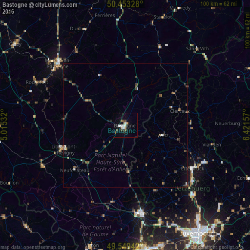
Analysis of Bastogne night lights 2016
Square area 10x10 km:
 2.52%
2.52%90-99
2.38%80-89
1.26%70-79
0.98%60-69
1.82%50-59
1.96%40-49
1.26%30-39
0.56%20-29
1.96%10-19
2.94%0-9
82.35%Square area 50x50 km:
0.21%90-99
0.24%80-89
0.12%70-79
0.15%60-69
0.36%50-59
0.38%40-49
0.49%30-39
0.59%20-29
0.67%10-19
0.6%0-9
96.18%Clear (daylight) street map image can be seen on geolist.org.
Map coordinates:
50° 27' 11.8" North, 5° 0' 55.2" East
50° 0' 12.5" North, 5° 43' 6.4" East
49° 32' 57.9" North, 6° 25' 17.7" East
Some cities around Bastogne sort by population:
• Habay-la-Vieille
31.9 km =19.8 mi,  192°
192°
• Vielsalm
34.2 km =21.3 mi,  24°
24°
• Neufchâteau
27.2 km =16.9 mi,  228°
228°
• Ettelbruck, LU
32.6 km =20.3 mi,  122°
122°
• Saint-Hubert
24.7 km =15.3 mi,  275°
275°
• Nassogne
30.2 km =18.8 mi,  297°
297°
• Wiltz, LU
16 km =9.9 mi,  105°
105°
• Redange-sur-Attert, LU
29.3 km =18.2 mi,  155°
155°
2802583 (p: 14,395)
Sources (retrieved 2019-11-25):
» Earth at Night: Flat Maps 2012, 2016