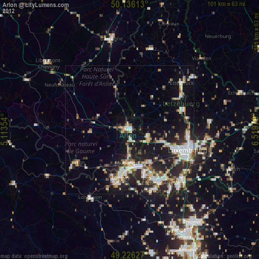
Arlon night lights from space
Night Light of Arlon (Wallonia) from space (Belgium) Src. Average luminocity for 10x10km area is 21.3864% and for 50x50km: 16.6603%.
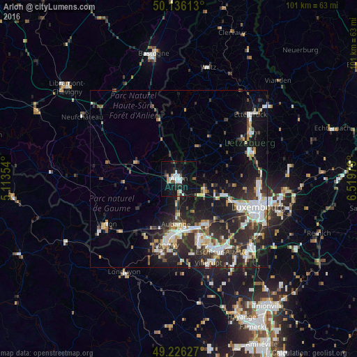
Analysis of Arlon night lights 2016
Square area 10x10 km:
 4.28%
4.28%90-99
4.28%80-89
1.07%70-79
1.07%60-69
1.07%50-59
3.48%40-49
1.2%30-39
2.54%20-29
3.88%10-19
29.95%0-9
47.19%Square area 50x50 km:
3.1%90-99
3.17%80-89
1.71%70-79
1.43%60-69
1.5%50-59
1.54%40-49
2.06%30-39
3%20-29
7.27%10-19
11.59%0-9
63.63%Clear (daylight) street map image can be seen on geolist.org.
Map coordinates:
50° 8' 10.1" North, 5° 6' 48.7" East
49° 40' 60" North, 5° 49' 0" East
49° 13' 34.6" North, 6° 31' 11.2" East
Some cities around Arlon sort by population:
• Aubange
13 km =8.1 mi,  183°
183°
• Mont-Saint-Martin, FR
15.7 km =9.8 mi,  188°
188°
• Habay-la-Vieille
14.8 km =9.2 mi,  287°
287°
• Pétange, LU
14.6 km =9.1 mi,  161°
161°
• Messancy
10.2 km =6.3 mi, 179°
• Étalle
15.6 km =9.7 mi,  266°
266°
• Mamer, LU
16.1 km =10 mi,  112°
112°
• Redange-sur-Attert, LU
10.4 km =6.5 mi,  30°
30°
2803073 (p: 26,179)
Sources (retrieved 2019-11-25):
» Earth at Night: Flat Maps 2012, 2016