Mamer night lights from space
Night Light of Mamer (Capellen) from space (Luxembourg) Src. Average luminocity for 10x10km area is 38.8641% and for 50x50km: 20.4515%.
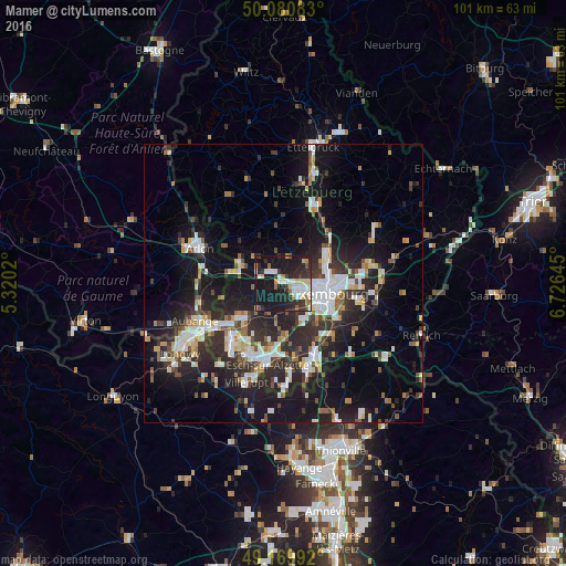
Analysis of Mamer night lights 2016
Square area 10x10 km:
 7.28%
7.28%90-99
8.4%80-89
4.34%70-79
3.22%60-69
3.22%50-59
2.66%40-49
1.82%30-39
7.84%20-29
18.63%10-19
41.46%0-9
1.12%Square area 50x50 km:
3.54%90-99
3.72%80-89
2.04%70-79
1.71%60-69
1.61%50-59
2.08%40-49
2.52%30-39
3.4%20-29
8.73%10-19
17.71%0-9
52.95%Clear (daylight) street map image can be seen on geolist.org.
Map coordinates:
50° 4' 51" North, 5° 19' 12.7" East
49° 37' 39" North, 6° 1' 24" East
49° 10' 11.7" North, 6° 43' 35.2" East
Some cities around Mamer sort by population:
• Luxembourg
7.9 km =4.9 mi,  102°
102°
• Schifflange
13.5 km =8.4 mi,  183°
183°
• Bettembourg
13.4 km =8.3 mi,  154°
154°
• Pétange
12.8 km =8 mi,  233°
233°
• Strassen
3.7 km =2.3 mi, 102°
• Bertrange
2.6 km =1.6 mi,  133°
133°
• Belvaux
14.9 km =9.3 mi,  208°
208°
• Mersch
14.8 km =9.2 mi,  23°
23°
2960299 (p: 5,017)
Sources (retrieved 2019-11-25):
» Earth at Night: Flat Maps 2012, 2016