Puthia night lights from space
Night Light of Puthia (Rajshahi Division) from space (Bangladesh) Src. Average luminocity for 10x10km area is 2.6171% and for 50x50km: 5.2435%.
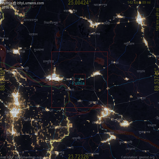
Analysis of Puthia night lights 2016
Square area 10x10 km:
 0%
0%90-99
0%80-89
0%70-79
0%60-69
0.79%50-59
0%40-49
0.79%30-39
3.17%20-29
0.79%10-19
0.4%0-9
94.05%Square area 50x50 km:
0.53%90-99
1.11%80-89
0.36%70-79
0.49%60-69
0.37%50-59
0.56%40-49
0.77%30-39
1.16%20-29
2.17%10-19
3.84%0-9
88.63%Clear (daylight) street map image can be seen on geolist.org.
Map coordinates:
25° 0' 15.3" North, 88° 7' 52.3" East
24° 21' 55.3" North, 88° 50' 3.5" East
23° 43' 23.7" North, 89° 32' 14.8" East
Some cities around Puthia sort by population:
• Rājshāhi
23.6 km =14.7 mi,  272°
272°
• Natore
16.3 km =10.1 mi,  71°
71°
• Pār Naogaon
50.1 km =31.1 mi,  13°
13°
• Pābna
57.1 km =35.5 mi,  134°
134°
• Ishurdi
35.3 km =21.9 mi,  138°
138°
• Bherāmāra
41.1 km =25.5 mi,  157°
157°
• Debīpur, IN
25.4 km =15.8 mi,  239°
239°
• Karīmpur, IN
48.5 km =30.1 mi,  206°
206°
7483743 (p: 159,406)
Sources (retrieved 2019-11-25):
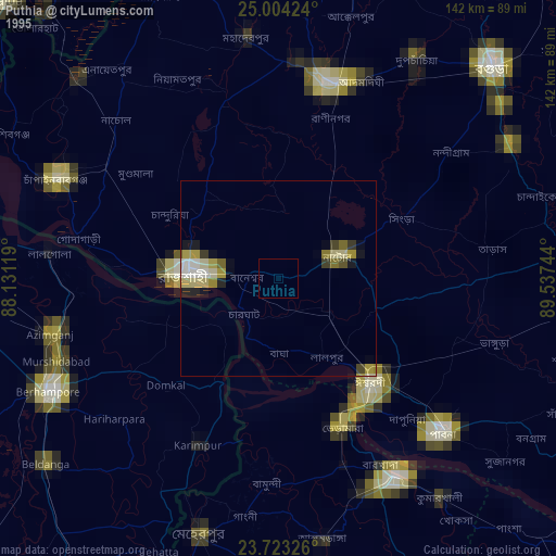
» NASA, Earths city lights 1995
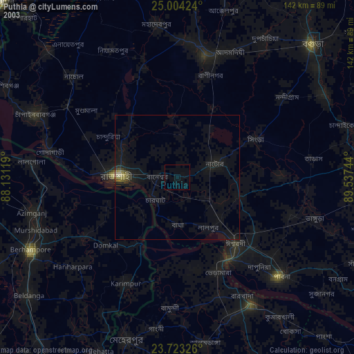
» NASA city lights 2003
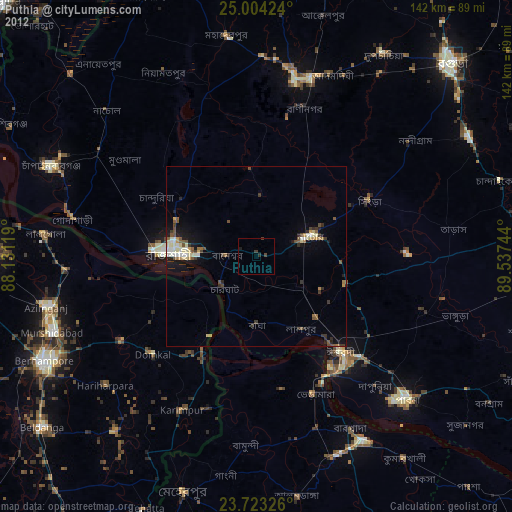
» Earth at Night: Flat Maps 2012, 2016