Ishurdi night lights from space
Night Light of Ishurdi (Rajshahi Division) from space (Bangladesh) Src. Average luminocity for 10x10km area is 48.7102% and for 50x50km: 8.5059%.
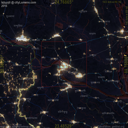
Analysis of Ishurdi night lights 2016
Square area 10x10 km:
 4.17%
4.17%90-99
14.58%80-89
6.06%70-79
7.2%60-69
8.33%50-59
6.82%40-49
4.92%30-39
7.01%20-29
12.31%10-19
22.16%0-9
6.44%Square area 50x50 km:
0.27%90-99
1.65%80-89
0.89%70-79
0.98%60-69
0.78%50-59
1.19%40-49
1.69%30-39
1.8%20-29
2.8%10-19
7.67%0-9
80.27%Clear (daylight) street map image can be seen on geolist.org.
Map coordinates:
24° 46' 7.1" North, 88° 21' 45.4" East
24° 7' 42.9" North, 89° 3' 56.6" East
23° 29' 7" North, 89° 46' 7.9" East
Some cities around Ishurdi sort by population:
• Natore
32.4 km =20.1 mi,  345°
345°
• Pābna
22.1 km =13.7 mi,  127°
127°
• Puthia
35.3 km =21.9 mi,  318°
318°
• Kushtia
25.7 km =16 mi,  167°
167°
• Shāhzādpur
54.3 km =33.7 mi,  84°
84°
• Bherāmāra
13.8 km =8.6 mi,  212°
212°
• Debīpur, IN
47.4 km =29.5 mi,  286°
286°
• Karīmpur, IN
48.4 km =30.1 mi,  249°
249°
1185207 (p: 81,995)
Sources (retrieved 2019-11-25):
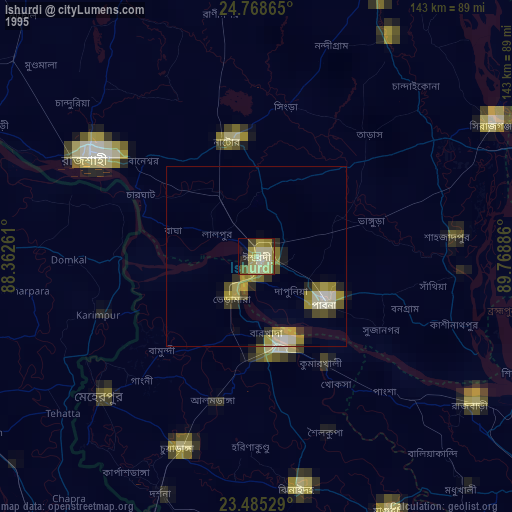
» NASA, Earths city lights 1995
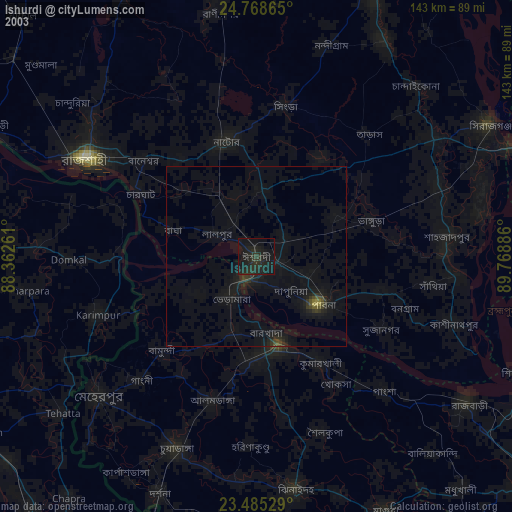
» NASA city lights 2003
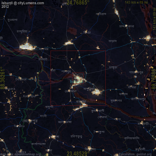
» Earth at Night: Flat Maps 2012, 2016