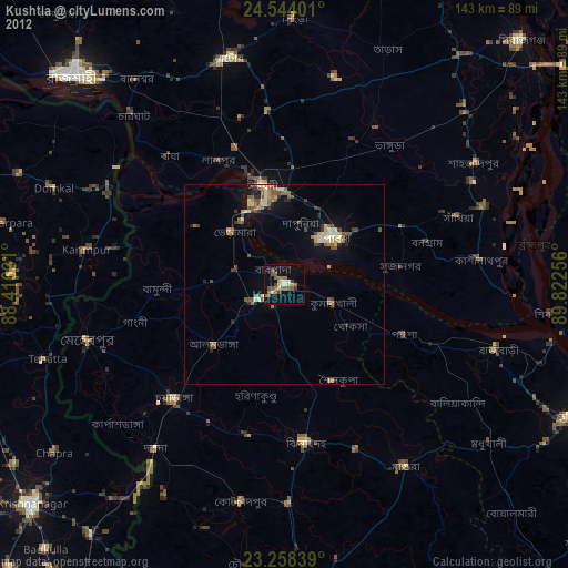
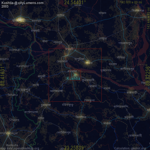
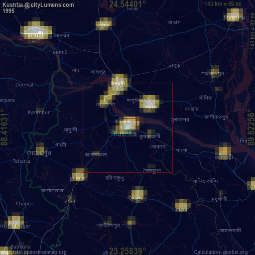
Kushtia night lights from space
Night Light of Kushtia (Khulna) from space (Bangladesh) Src. Average luminocity for 10x10km area is 34.2877% and for 50x50km: 8.626%.
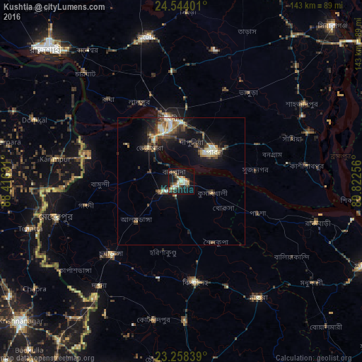
Analysis of Kushtia night lights 2016
Square area 10x10 km:
 1.39%
1.39%90-99
9.92%80-89
4.56%70-79
3.77%60-69
4.37%50-59
4.37%40-49
3.57%30-39
7.54%20-29
3.77%10-19
37.3%0-9
19.44%Square area 50x50 km:
0.31%90-99
1.86%80-89
0.99%70-79
0.9%60-69
0.93%50-59
1.16%40-49
1.59%30-39
1.84%20-29
2.33%10-19
7.5%0-9
80.59%Clear (daylight) street map image can be seen on geolist.org.
Map coordinates:
24° 32' 38.4" North, 88° 24' 58.7" East
23° 54' 10.1" North, 89° 7' 9.9" East
23° 15' 30.2" North, 89° 49' 21.2" East
Some cities around Kushtia sort by population:
• Natore
58.1 km =36.1 mi,  346°
346°
• Pābna
16.6 km =10.3 mi,  46°
46°
• Shāhzādpur
57.4 km =35.7 mi,  57°
57°
• Ishurdi
25.7 km =16 mi, 347°
• Kālīganj
54.9 km =34.1 mi,  178°
178°
• Bera
55.7 km =34.6 mi,  69°
69°
• Bherāmāra
18.7 km =11.6 mi,  316°
316°
• Karīmpur, IN
51.5 km =32 mi,  279°
279°
1185191 (p: 135,724)
Sources (retrieved 2019-11-25):
» NASA, Earths city lights 1995
» NASA city lights 2003
» Earth at Night: Flat Maps 2012, 2016