Chittagong night lights from space
Night Light of Chittagong from space (Bangladesh) Src. Average luminocity for 10x10km area is 90.8144% and for 50x50km: 18.2096%.
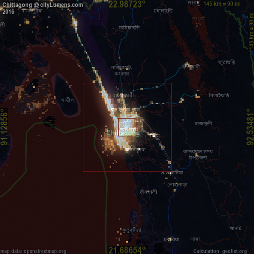
Analysis of Chittagong night lights 2016
Square area 10x10 km:
 28.79%
90-99
39.58%80-89
17.05%70-79
3.98%60-69
4.17%50-59
5.3%40-49
0.95%30-39
0.19%20-29
0%10-19
0%0-9
0%Square area 50x50 km:
2.69%90-99
3.94%80-89
2.79%70-79
1.17%60-69
1.83%50-59
2.63%40-49
3.89%30-39
3.34%20-29
4.21%10-19
8.21%0-9
65.32%Clear (daylight) street map image can be seen on geolist.org.
Map coordinates:
22° 59' 14" North, 91° 7' 42.8" East
22° 20' 18.2" North, 91° 49' 54" East
21° 41' 11.5" North, 92° 32' 5.3" East
Some cities around Chittagong sort by population:
• Bibir Hat
38.6 km =24 mi,  353°
353°
• Sandwīp
43.4 km =27 mi,  296°
296°
• Sātkania
36.8 km =22.9 mi,  142°
142°
• Patiya
15.9 km =9.9 mi,  107°
107°
• Bāndarban
43 km =26.7 mi, 111°
• Raojān
23.6 km =14.7 mi,  22°
22°
• Manikchari
55.7 km =34.6 mi,  1°
1°
• Sabrūm, IN
74.6 km =46.4 mi, 351°
1205733 (p: 3,920,222)
Sources (retrieved 2019-11-25):
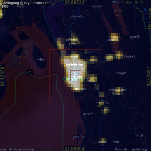
» NASA, Earths city lights 1995
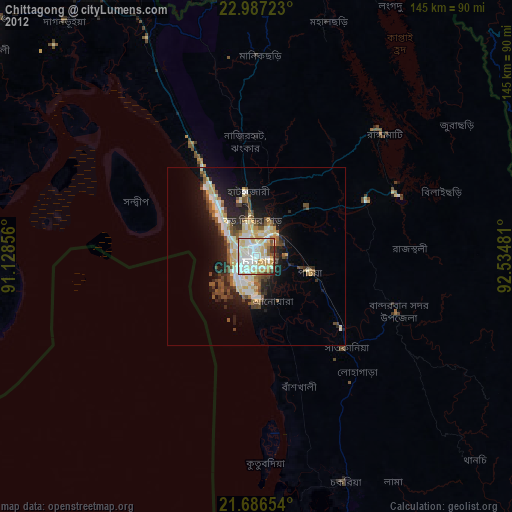
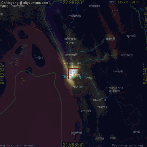
» NASA city lights 2003
» Earth at Night: Flat Maps 2012, 2016