Mejdan - Obilićevo night lights from space
Night Light of Mejdan - Obilićevo (Srpska) from space (Bosnia and Herzegovina) Src. Average luminocity for 10x10km area is 44.9424% and for 50x50km: 4.6286%.
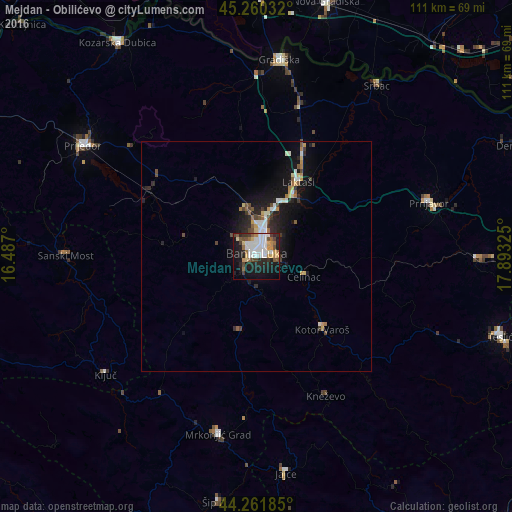
Analysis of Mejdan - Obilićevo night lights 2016
Square area 10x10 km:
 12.27%
90-99
9.09%80-89
3.79%70-79
5%60-69
4.85%50-59
5%40-49
4.7%30-39
4.39%20-29
13.18%10-19
25.3%0-9
12.42%Square area 50x50 km:
0.75%90-99
0.78%80-89
0.44%70-79
0.48%60-69
0.49%50-59
0.51%40-49
0.67%30-39
0.51%20-29
1.47%10-19
4.18%0-9
89.72%Clear (daylight) street map image can be seen on geolist.org.
Map coordinates:
45° 15' 37.2" North, 16° 29' 13.2" East
44° 45' 47.7" North, 17° 11' 24.4" East
44° 15' 42.7" North, 17° 53' 35.7" East
Some cities around Mejdan - Obilićevo sort by population:
• Banja Luka
1.7 km =1.1 mi,  9°
9°
• Trn
11.2 km =7 mi,  18°
18°
• Prnjavor
39.1 km =24.3 mi,  72°
72°
• Kneževo
33.9 km =21.1 mi,  153°
153°
• Čelinac
11.4 km =7.1 mi,  112°
112°
• Omarska
27.1 km =16.8 mi,  301°
301°
• Laktaši
18.4 km =11.4 mi,  28°
28°
• Kotor Varoš
21.6 km =13.4 mi,  138°
138°
8335444 (p: 5,400)
Sources (retrieved 2019-11-25):
» Earth at Night: Flat Maps 2012, 2016