Čelinac night lights from space
Night Light of Čelinac (Srpska) from space (Bosnia and Herzegovina) Src. Average luminocity for 10x10km area is 1.9394% and for 50x50km: 4.3241%.
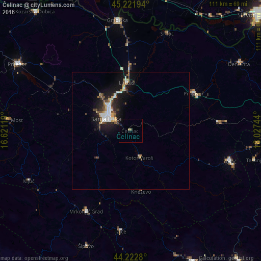
Analysis of Čelinac night lights 2016
Square area 10x10 km:
 0%
0%90-99
0%80-89
0.61%70-79
0.61%60-69
0%50-59
0%40-49
0%30-39
0%20-29
0%10-19
2.12%0-9
96.67%Square area 50x50 km:
0.75%90-99
0.71%80-89
0.42%70-79
0.45%60-69
0.47%50-59
0.49%40-49
0.56%30-39
0.48%20-29
1.3%10-19
4.06%0-9
90.31%Clear (daylight) street map image can be seen on geolist.org.
Map coordinates:
45° 13' 19" North, 16° 37' 16.3" East
44° 43' 28.3" North, 17° 19' 27.5" East
44° 13' 22.1" North, 18° 1' 38.8" East
Some cities around Čelinac sort by population:
• Banja Luka
11.9 km =7.4 mi,  300°
300°
• Trn
16.4 km =10.2 mi,  334°
334°
• Prnjavor
31.2 km =19.4 mi,  58°
58°
• Kneževo
26.4 km =16.4 mi,  170°
170°
• Omarska
38.4 km =23.9 mi, 298°
• Laktaši
20.5 km =12.7 mi,  354°
354°
• Mejdan - Obilićevo
11.4 km =7.1 mi,  292°
292°
• Kotor Varoš
12.4 km =7.7 mi,  162°
162°
3247554 (p: 6,670)
Sources (retrieved 2019-11-25):
» Earth at Night: Flat Maps 2012, 2016