Banja Luka night lights from space
Night Light of Banja Luka (Srpska) from space (Bosnia and Herzegovina) Src. Average luminocity for 10x10km area is 51.5197% and for 50x50km: 4.6521%.
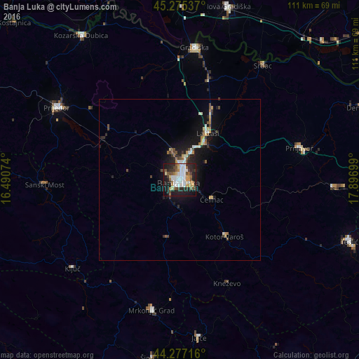
Analysis of Banja Luka night lights 2016
Square area 10x10 km:
 14.09%
90-99
10.91%80-89
4.39%70-79
5.61%60-69
5.15%50-59
6.06%40-49
5.61%30-39
5%20-29
19.55%10-19
21.21%0-9
2.42%Square area 50x50 km:
0.75%90-99
0.78%80-89
0.44%70-79
0.48%60-69
0.49%50-59
0.51%40-49
0.69%30-39
0.51%20-29
1.47%10-19
4.18%0-9
89.69%Clear (daylight) street map image can be seen on geolist.org.
Map coordinates:
45° 16' 31.3" North, 16° 29' 26.7" East
44° 46' 42.3" North, 17° 11' 37.9" East
44° 16' 37.8" North, 17° 53' 49.2" East
Some cities around Banja Luka sort by population:
• Trn
9.5 km =5.9 mi,  20°
20°
• Prnjavor
38.3 km =23.8 mi,  74°
74°
• Kneževo
35.3 km =21.9 mi,  155°
155°
• Čelinac
11.9 km =7.4 mi,  120°
120°
• Omarska
26.5 km =16.5 mi,  298°
298°
• Laktaši
16.8 km =10.4 mi,  30°
30°
• Mejdan - Obilićevo
1.7 km =1.1 mi,  189°
189°
• Kotor Varoš
22.7 km =14.1 mi,  141°
141°
3204541 (p: 221,106)
Sources (retrieved 2019-11-25):
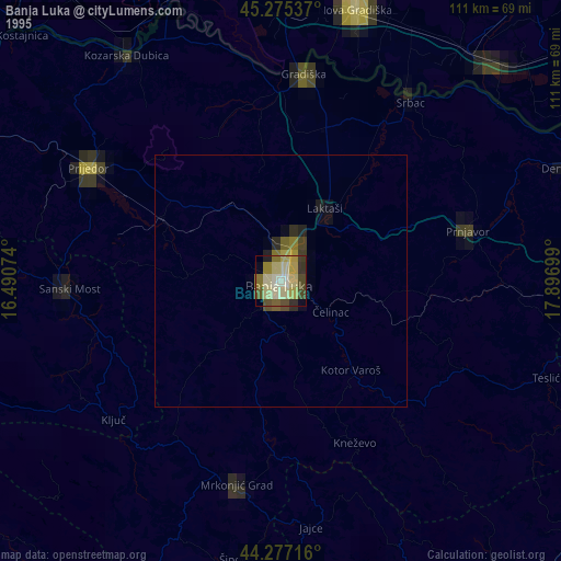
» NASA, Earths city lights 1995
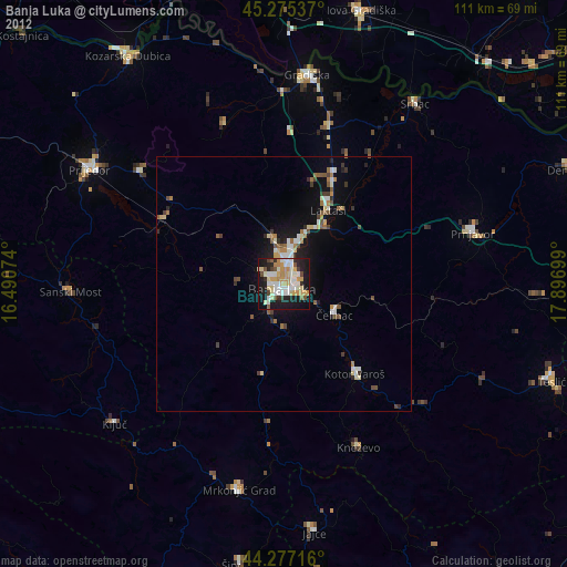
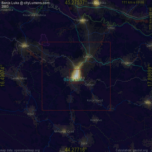
» NASA city lights 2003
» Earth at Night: Flat Maps 2012, 2016