Kotor Varoš night lights from space
Night Light of Kotor Varoš (Srpska) from space (Bosnia and Herzegovina) Src. Average luminocity for 10x10km area is 2.6894% and for 50x50km: 3.2537%.
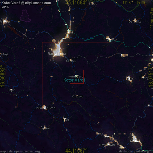
Analysis of Kotor Varoš night lights 2016
Square area 10x10 km:
 0%
0%90-99
0.61%80-89
0.45%70-79
0.76%60-69
0.61%50-59
0%40-49
0.61%30-39
0.61%20-29
0%10-19
0%0-9
96.36%Square area 50x50 km:
0.65%90-99
0.62%80-89
0.24%70-79
0.34%60-69
0.32%50-59
0.35%40-49
0.45%30-39
0.46%20-29
1.1%10-19
2.05%0-9
93.41%Clear (daylight) street map image can be seen on geolist.org.
Map coordinates:
45° 6' 59.9" North, 16° 40' 8.1" East
44° 37' 5.9" North, 17° 22' 19.3" East
44° 6' 56.4" North, 18° 4' 30.6" East
Some cities around Kotor Varoš sort by population:
• Banja Luka
22.7 km =14.1 mi,  321°
321°
• Mrkonjić Grad
32 km =19.9 mi,  225°
225°
• Jajce
31.8 km =19.8 mi,  194°
194°
• Trn
28.8 km =17.9 mi,  338°
338°
• Divičani
28.2 km =17.5 mi, 187°
• Kneževo
14.2 km =8.8 mi,  176°
176°
• Čelinac
12.4 km =7.7 mi, 342°
• Mejdan - Obilićevo
21.6 km =13.4 mi, 318°
3197532 (p: 5,068)
Sources (retrieved 2019-11-25):
» Earth at Night: Flat Maps 2012, 2016