Prnjavor night lights from space
Night Light of Prnjavor (Srpska) from space (Bosnia and Herzegovina) Src. Average luminocity for 10x10km area is 8.1651% and for 50x50km: 0.8464%.
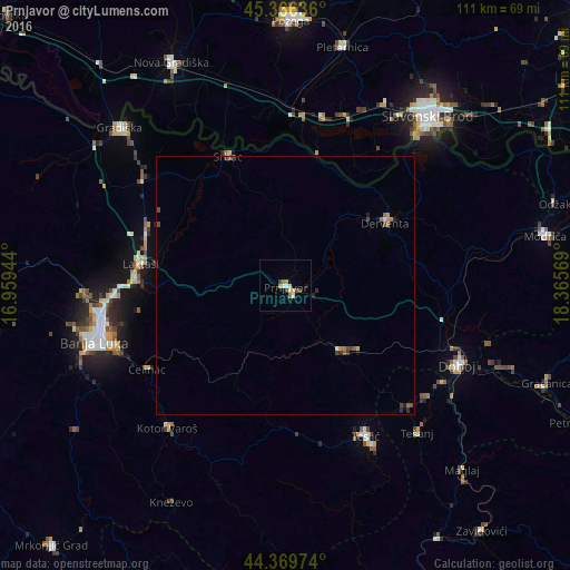
Analysis of Prnjavor night lights 2016
Square area 10x10 km:
 0.79%
0.79%90-99
1.11%80-89
1.9%70-79
1.27%60-69
1.27%50-59
0.63%40-49
1.27%30-39
0.63%20-29
0%10-19
0.63%0-9
90.48%Square area 50x50 km:
0.04%90-99
0.08%80-89
0.1%70-79
0.13%60-69
0.14%50-59
0.15%40-49
0.23%30-39
0.09%20-29
0.18%10-19
0.09%0-9
98.76%Clear (daylight) street map image can be seen on geolist.org.
Map coordinates:
45° 21' 58.9" North, 16° 57' 34" East
44° 52' 12.8" North, 17° 39' 45.2" East
44° 22' 11.1" North, 18° 21' 56.5" East
Some cities around Prnjavor sort by population:
• Derventa
22.7 km =14.1 mi,  58°
58°
• Trn
33.7 km =20.9 mi,  267°
267°
• Srbac
27.5 km =17.1 mi,  336°
336°
• Čelinac
31.2 km =19.4 mi,  238°
238°
• Laktaši
28.8 km =17.9 mi,  278°
278°
• Teslić
33.2 km =20.6 mi,  152°
152°
• Kalenderovci Donji
16.2 km =10.1 mi, 58°
• Jelah
33.5 km =20.8 mi,  135°
135°
3192327 (p: 7,099)
Sources (retrieved 2019-11-25):
» Earth at Night: Flat Maps 2012, 2016