Wynnum night lights from space
Night Light of Wynnum (Queensland) from space (Australia) Src. Average luminocity for 10x10km area is 70.1061% and for 50x50km: 40.8896%.
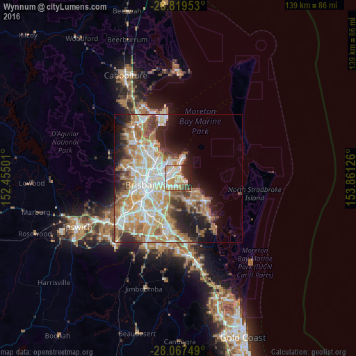
Analysis of Wynnum night lights 2016
Square area 10x10 km:
 18.56%
90-99
17.05%80-89
8.52%70-79
14.77%60-69
11.17%50-59
2.08%40-49
7.58%30-39
3.79%20-29
12.88%10-19
3.6%0-9
0%Square area 50x50 km:
8.42%90-99
9.12%80-89
5.52%70-79
6.17%60-69
10.16%50-59
3.32%40-49
3.67%30-39
3.71%20-29
6%10-19
8.36%0-9
35.53%Clear (daylight) street map image can be seen on geolist.org.
Map coordinates:
26° 49' 10.3" South, 152° 27' 18" East
27° 26' 43" South, 153° 9' 29.3" East
28° 4' 3" South, 153° 51' 40.5" East
Some cities around Wynnum sort by population:
• Carindale
8.7 km =5.4 mi,  219°
219°
• Birkdale
7.2 km =4.5 mi,  126°
126°
• Manly West
3.3 km =2.1 mi,  165°
165°
• Morningside
8.4 km =5.2 mi,  257°
257°
• Wakerley
4.2 km =2.6 mi,  183°
183°
• Tingalpa
4.4 km =2.7 mi, 224°
• Hamilton
9.4 km =5.8 mi,  274°
274°
• Cannon Hill
6.9 km =4.3 mi,  244°
244°
2142750 (p: 12,650)
Sources (retrieved 2019-11-25):
» Earth at Night: Flat Maps 2012, 2016