Wiley Park night lights from space
Night Light of Wiley Park (New South Wales) from space (Australia) Src. Average luminocity for 10x10km area is 93.1591% and for 50x50km: 55.0835%.
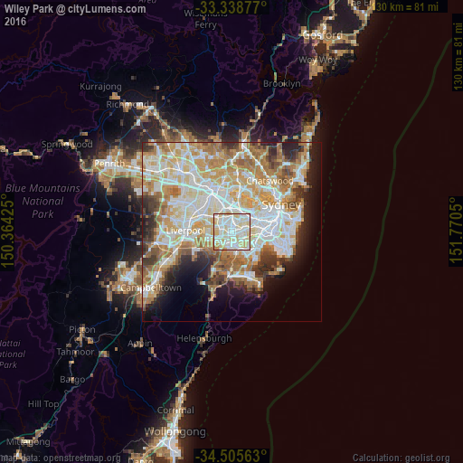
Analysis of Wiley Park night lights 2016
Square area 10x10 km:
 28.67%
90-99
41.08%80-89
23.95%70-79
4.9%60-69
1.4%50-59
0%40-49
0%30-39
0%20-29
0%10-19
0%0-9
0%Square area 50x50 km:
13.22%90-99
14.62%80-89
7.61%70-79
8.92%60-69
9.64%50-59
4.99%40-49
3.2%30-39
4.64%20-29
5.16%10-19
7.11%0-9
20.9%Clear (daylight) street map image can be seen on geolist.org.
Map coordinates:
33° 20' 19.6" South, 150° 21' 51.3" East
33° 55' 27.1" South, 151° 4' 2.5" East
34° 30' 20.3" South, 151° 46' 13.8" East
Some cities around Wiley Park sort by population:
• Greenacre
2.9 km =1.8 mi,  337°
337°
• Punchbowl
1.6 km =1 mi,  250°
250°
• Lakemba
0.9 km =0.6 mi,  57°
57°
• Belmore
2.1 km =1.3 mi,  74°
74°
• Roselands
1.1 km =0.7 mi,  151°
151°
• Beverly Hills
2.9 km =1.8 mi,  156°
156°
• Belfield
2.8 km =1.7 mi,  34°
34°
• Narwee
2.5 km =1.6 mi,  176°
176°
8348839 (p: 10,098)
Sources (retrieved 2019-11-25):
» Earth at Night: Flat Maps 2012, 2016