Punchbowl night lights from space
Night Light of Punchbowl (New South Wales) from space (Australia) Src. Average luminocity for 10x10km area is 91.9388% and for 50x50km: 55.6063%.
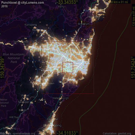
Analysis of Punchbowl night lights 2016
Square area 10x10 km:
 27.8%
27.8%90-99
39.34%80-89
20.98%70-79
7.87%60-69
3.85%50-59
0.17%40-49
0%30-39
0%20-29
0%10-19
0%0-9
0%Square area 50x50 km:
13.3%90-99
14.66%80-89
7.61%70-79
9.07%60-69
9.83%50-59
5.06%40-49
3.39%30-39
4.72%20-29
5.42%10-19
6.95%0-9
19.99%Clear (daylight) street map image can be seen on geolist.org.
Map coordinates:
33° 20' 36.7" South, 150° 20' 52.8" East
33° 55' 44.1" South, 151° 3' 4" East
34° 30' 37.2" South, 151° 45' 15.3" East
Some cities around Punchbowl sort by population:
• Bankstown
2.1 km =1.3 mi,  309°
309°
• Greenacre
3.2 km =2 mi,  7°
7°
• Lakemba
2.5 km =1.6 mi,  65°
65°
• Riverwood
2 km =1.2 mi,  183°
183°
• Roselands
2.1 km =1.3 mi,  103°
103°
• Wiley Park
1.6 km =1 mi, 70°
• Beverly Hills
3.4 km =2.1 mi,  128°
128°
• Narwee
2.6 km =1.6 mi,  139°
139°
8349222 (p: 20,174)
Sources (retrieved 2019-11-25):
» Earth at Night: Flat Maps 2012, 2016