Narwee night lights from space
Night Light of Narwee (New South Wales) from space (Australia) Src. Average luminocity for 10x10km area is 87.722% and for 50x50km: 51.627%.
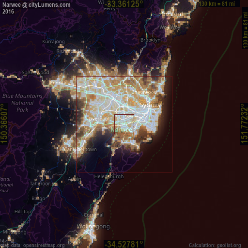
Analysis of Narwee night lights 2016
Square area 10x10 km:
 24.48%
90-99
33.74%80-89
17.83%70-79
7.69%60-69
10.31%50-59
3.85%40-49
1.92%30-39
0.17%20-29
0%10-19
0%0-9
0%Square area 50x50 km:
12.91%90-99
14.14%80-89
7.27%70-79
8.24%60-69
8.3%50-59
4.31%40-49
2.82%30-39
3.93%20-29
4.34%10-19
6.57%0-9
27.16%Clear (daylight) street map image can be seen on geolist.org.
Map coordinates:
33° 21' 40.5" South, 150° 21' 57.9" East
33° 56' 47.5" South, 151° 4' 9.1" East
34° 31' 40.1" South, 151° 46' 20.4" East
Some cities around Narwee sort by population:
• Punchbowl
2.6 km =1.6 mi,  319°
319°
• Penshurst
2.6 km =1.6 mi,  149°
149°
• Riverwood
1.8 km =1.1 mi,  267°
267°
• Roselands
1.5 km =0.9 mi,  13°
13°
• Peakhurst
2.4 km =1.5 mi,  221°
221°
• Mortdale
2.5 km =1.6 mi,  173°
173°
• Wiley Park
2.5 km =1.6 mi,  356°
356°
• Beverly Hills
1 km =0.6 mi,  99°
99°
8348724 (p: 5,636)
Sources (retrieved 2019-11-25):
» Earth at Night: Flat Maps 2012, 2016