Wentworth Point night lights from space
Night Light of Wentworth Point (New South Wales) from space (Australia) Src. Average luminocity for 10x10km area is 90.7395% and for 50x50km: 57.0031%.
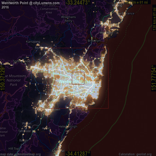
Analysis of Wentworth Point night lights 2016
Square area 10x10 km:
 29.72%
90-99
28.15%80-89
22.03%70-79
20.1%60-69
0%50-59
0%40-49
0%30-39
0%20-29
0%10-19
0%0-9
0%Square area 50x50 km:
13.18%90-99
14.6%80-89
7.63%70-79
9.07%60-69
10.49%50-59
5.35%40-49
3.64%30-39
5.25%20-29
6.7%10-19
9.07%0-9
15.04%Clear (daylight) street map image can be seen on geolist.org.
Map coordinates:
33° 14' 41" South, 150° 22' 16.6" East
33° 49' 50.9" South, 151° 4' 27.9" East
34° 24' 46.3" South, 151° 46' 39.1" East
Some cities around Wentworth Point sort by population:
• Ryde
3.2 km =2 mi,  65°
65°
• Concord
3.3 km =2.1 mi,  123°
123°
• West Ryde
2.8 km =1.7 mi,  358°
358°
• Rhodes
1.3 km =0.8 mi, 69°
• Ermington
2.5 km =1.6 mi,  314°
314°
• Homebush West
3.6 km =2.2 mi,  190°
190°
• Concord West
2.2 km =1.4 mi,  150°
150°
• Newington
1.7 km =1.1 mi,  254°
254°
8347990 (p: 6,937)
Sources (retrieved 2019-11-25):
» Earth at Night: Flat Maps 2012, 2016