Rhodes night lights from space
Night Light of Rhodes (New South Wales) from space (Australia) Src. Average luminocity for 10x10km area is 89.6311% and for 50x50km: 55.6251%.
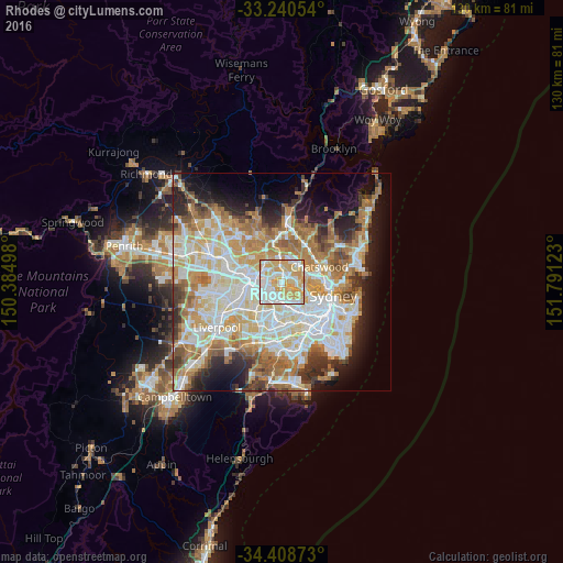
Analysis of Rhodes night lights 2016
Square area 10x10 km:
 27.62%
90-99
25.7%80-89
22.38%70-79
24.3%60-69
0%50-59
0%40-49
0%30-39
0%20-29
0%10-19
0%0-9
0%Square area 50x50 km:
12.93%90-99
14.38%80-89
7.51%70-79
8.94%60-69
10.17%50-59
5.13%40-49
3.34%30-39
4.77%20-29
6.15%10-19
8.92%0-9
17.75%Clear (daylight) street map image can be seen on geolist.org.
Map coordinates:
33° 14' 25.9" South, 150° 23' 5.9" East
33° 49' 35.9" South, 151° 5' 17.2" East
34° 24' 31.4" South, 151° 47' 28.4" East
Some cities around Rhodes sort by population:
• Ryde
1.9 km =1.2 mi,  62°
62°
• Eastwood
3.9 km =2.4 mi,  349°
349°
• Concord
2.7 km =1.7 mi,  147°
147°
• West Ryde
2.7 km =1.7 mi,  330°
330°
• Ermington
3.4 km =2.1 mi,  293°
293°
• Wentworth Point
1.3 km =0.8 mi,  249°
249°
• Concord West
2.4 km =1.5 mi,  184°
184°
• Newington
3 km =1.9 mi, 252°
2151682 (p: 11,828)
Sources (retrieved 2019-11-25):
» Earth at Night: Flat Maps 2012, 2016