Tapping night lights from space
Night Light of Tapping (Western Australia) from space (Australia) Src. Average luminocity for 10x10km area is 56.4212% and for 50x50km: 24.1171%.
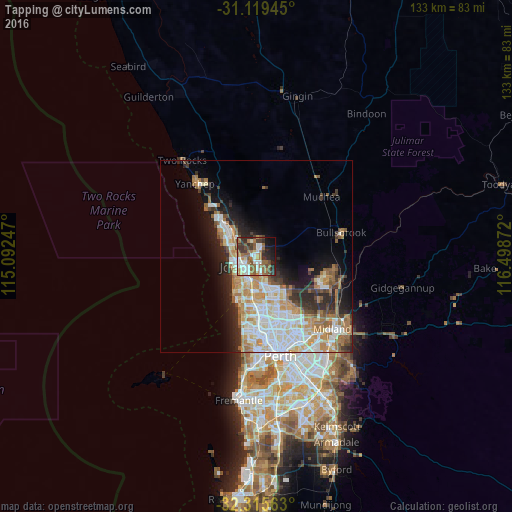
Analysis of Tapping night lights 2016
Square area 10x10 km:
 12.64%
90-99
9.71%80-89
3.85%70-79
3.66%60-69
14.1%50-59
13.74%40-49
8.24%30-39
9.89%20-29
10.99%10-19
10.07%0-9
3.11%Square area 50x50 km:
5.29%90-99
5.6%80-89
2.15%70-79
3.31%60-69
4.72%50-59
2.61%40-49
1.75%30-39
2.92%20-29
4.75%10-19
7.38%0-9
59.51%Clear (daylight) street map image can be seen on geolist.org.
Map coordinates:
31° 7' 10" South, 115° 5' 32.9" East
31° 43' 10.1" South, 115° 47' 44.1" East
32° 18' 56.3" South, 116° 29' 55.4" East
Some cities around Tapping sort by population:
• Wanneroo
3.4 km =2.1 mi,  172°
172°
• Joondalup
3.8 km =2.4 mi,  222°
222°
• Banksia Grove
2.7 km =1.7 mi,  18°
18°
• Carramar
4 km =2.5 mi,  325°
325°
• Currambine
4.8 km =3 mi,  251°
251°
• Kinross
5.4 km =3.4 mi,  270°
270°
• Heathridge
5.9 km =3.7 mi, 215°
• Hocking
6 km =3.7 mi,  159°
159°
8347750 (p: 9,243)
Sources (retrieved 2019-11-25):
» Earth at Night: Flat Maps 2012, 2016