Currambine night lights from space
Night Light of Currambine (Western Australia) from space (Australia) Src. Average luminocity for 10x10km area is 64.1245% and for 50x50km: 23.7008%.
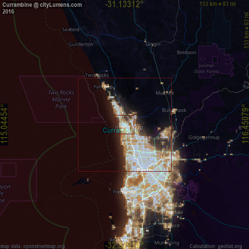
Analysis of Currambine night lights 2016
Square area 10x10 km:
 14.65%
90-99
14.1%80-89
6.78%70-79
8.61%60-69
12.82%50-59
9.89%40-49
6.96%30-39
8.42%20-29
12.09%10-19
5.68%0-9
0%Square area 50x50 km:
5.63%90-99
6.01%80-89
2.19%70-79
3.34%60-69
4.13%50-59
2.14%40-49
1.5%30-39
2.42%20-29
4.41%10-19
6.59%0-9
61.65%Clear (daylight) street map image can be seen on geolist.org.
Map coordinates:
31° 7' 59.2" South, 115° 2' 40.3" East
31° 43' 59" South, 115° 44' 51.6" East
32° 19' 44.9" South, 116° 27' 2.8" East
Some cities around Currambine sort by population:
• Joondalup
2.3 km =1.4 mi,  122°
122°
• Tapping
4.8 km =3 mi,  71°
71°
• Ocean Reef
3.1 km =1.9 mi,  201°
201°
• Carramar
5.3 km =3.3 mi,  25°
25°
• Kinross
1.8 km =1.1 mi,  331°
331°
• Heathridge
3.4 km =2.1 mi,  161°
161°
• Mullaloo
5.2 km =3.2 mi,  191°
191°
• Iluka
1.6 km =1 mi,  260°
260°
6697152 (p: 6,771)
Sources (retrieved 2019-11-25):
» Earth at Night: Flat Maps 2012, 2016