Blakehurst night lights from space
Night Light of Blakehurst (New South Wales) from space (Australia) Src. Average luminocity for 10x10km area is 76.5839% and for 50x50km: 41.3299%.
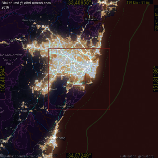
Analysis of Blakehurst night lights 2016
Square area 10x10 km:
 19.58%
90-99
22.55%80-89
7.17%70-79
10.49%60-69
17.48%50-59
9.62%40-49
2.97%30-39
7.69%20-29
2.45%10-19
0%0-9
0%Square area 50x50 km:
11.23%90-99
11.89%80-89
5.84%70-79
6.11%60-69
5.39%50-59
3.26%40-49
1.99%30-39
2.49%20-29
3.45%10-19
5.83%0-9
42.51%Clear (daylight) street map image can be seen on geolist.org.
Map coordinates:
33° 24' 23.6" South, 150° 24' 20.3" East
33° 59' 29.5" South, 151° 6' 31.5" East
34° 34' 21" South, 151° 48' 42.8" East
Some cities around Blakehurst sort by population:
• Hurstville
2.7 km =1.7 mi,  345°
345°
• Kogarah
3.6 km =2.2 mi,  43°
43°
• Carlton
2.6 km =1.6 mi,  27°
27°
• Sylvania
2.6 km =1.6 mi,  204°
204°
• Sans Souci
2.3 km =1.4 mi,  85°
85°
• Allawah
2.2 km =1.4 mi,  13°
13°
• Oyster Bay
3.3 km =2.1 mi,  245°
245°
• South Hurstville
1.6 km =1 mi, 349°
2206003 (p: 6,141)
Sources (retrieved 2019-11-25):
» Earth at Night: Flat Maps 2012, 2016