Southport night lights from space
Night Light of Southport (Queensland) from space (Australia) Src. Average luminocity for 10x10km area is 74.072% and for 50x50km: 16.6891%.
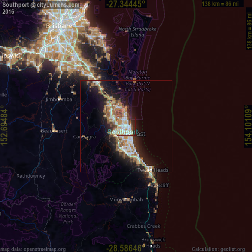
Analysis of Southport night lights 2016
Square area 10x10 km:
 23.11%
90-99
23.67%80-89
4.92%70-79
11.55%60-69
11.36%50-59
2.65%40-49
3.03%30-39
4.36%20-29
11.36%10-19
3.98%0-9
0%Square area 50x50 km:
2.89%90-99
3.06%80-89
1.46%70-79
1.21%60-69
4.87%50-59
1.78%40-49
1.84%30-39
2.03%20-29
4.22%10-19
10.12%0-9
66.49%Clear (daylight) street map image can be seen on geolist.org.
Map coordinates:
27° 20' 40" South, 152° 41' 41.4" East
27° 58' 2.1" South, 153° 23' 52.7" East
28° 35' 11.3" South, 154° 6' 3.9" East
Some cities around Southport sort by population:
• Labrador
2.6 km =1.6 mi,  0°
0°
• Ashmore
3.2 km =2 mi,  221°
221°
• Arundel
4.8 km =3 mi,  313°
313°
• Benowa
4.7 km =2.9 mi,  194°
194°
• Biggera Waters
3.9 km =2.4 mi, 3°
• Parkwood
3.7 km =2.3 mi,  292°
292°
• Molendinar
3.7 km =2.3 mi,  258°
258°
• Main Beach
3.1 km =1.9 mi,  114°
114°
2148928 (p: 32,965)
Sources (retrieved 2019-11-25):
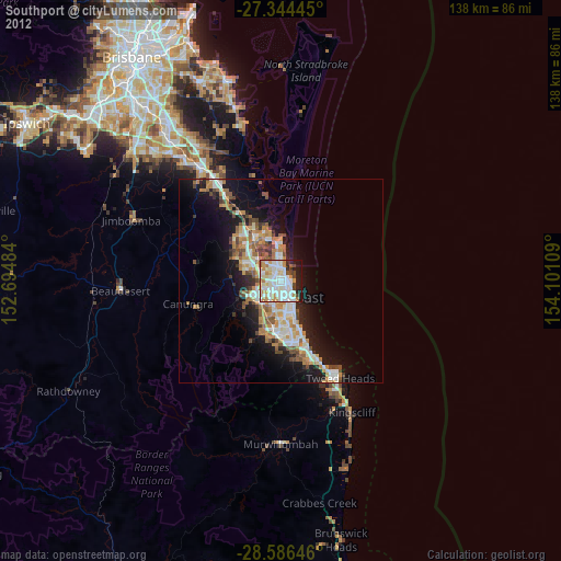
» Earth at Night: Flat Maps 2012, 2016