Seven Hills night lights from space
Night Light of Seven Hills (New South Wales) from space (Australia) Src. Average luminocity for 10x10km area is 89.7985% and for 50x50km: 50.7452%.
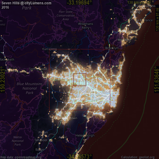
Analysis of Seven Hills night lights 2016
Square area 10x10 km:
 25.46%
90-99
33.15%80-89
22.71%70-79
13.92%60-69
2.93%50-59
1.83%40-49
0%30-39
0%20-29
0%10-19
0%0-9
0%Square area 50x50 km:
11.71%90-99
12.77%80-89
7.08%70-79
8.67%60-69
8.53%50-59
4.26%40-49
3.33%30-39
4.93%20-29
6.2%10-19
8.07%0-9
24.42%Clear (daylight) street map image can be seen on geolist.org.
Map coordinates:
33° 11' 49" South, 150° 13' 48.8" East
33° 46' 60" South, 150° 55' 60" East
34° 21' 56.6" South, 151° 38' 11.3" East
Some cities around Seven Hills sort by population:
• Blacktown
2.4 km =1.5 mi,  320°
320°
• Toongabbie
1.5 km =0.9 mi,  90°
90°
• Winston Hills
4.4 km =2.7 mi,  80°
80°
• Wentworthville
4.1 km =2.5 mi,  128°
128°
• Kings Langley
3.7 km =2.3 mi,  2°
2°
• Lalor Park
2.5 km =1.6 mi,  355°
355°
• Pendle Hill
3.1 km =1.9 mi,  138°
138°
• Girraween
2 km =1.2 mi,  152°
152°
2149847 (p: 19,196)
Sources (retrieved 2019-11-25):
» Earth at Night: Flat Maps 2012, 2016