Lalor Park night lights from space
Night Light of Lalor Park (New South Wales) from space (Australia) Src. Average luminocity for 10x10km area is 90.3168% and for 50x50km: 48.7197%.
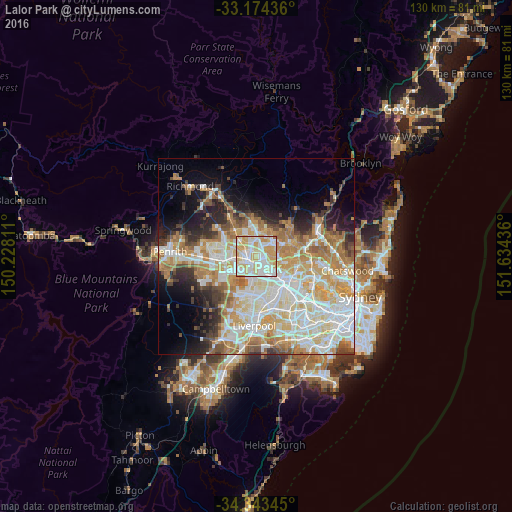
Analysis of Lalor Park night lights 2016
Square area 10x10 km:
 26.19%
90-99
32.42%80-89
23.08%70-79
17.03%60-69
1.28%50-59
0%40-49
0%30-39
0%20-29
0%10-19
0%0-9
0%Square area 50x50 km:
11.56%90-99
12.58%80-89
6.89%70-79
8.48%60-69
7.94%50-59
3.6%40-49
3.18%30-39
4.16%20-29
5.24%10-19
7.73%0-9
28.65%Clear (daylight) street map image can be seen on geolist.org.
Map coordinates:
33° 10' 27.7" South, 150° 13' 41.2" East
33° 45' 39.2" South, 150° 55' 52.4" East
34° 20' 36.4" South, 151° 38' 3.7" East
Some cities around Lalor Park sort by population:
• Blacktown
1.5 km =0.9 mi,  244°
244°
• Seven Hills
2.5 km =1.6 mi,  175°
175°
• Glenwood
3.1 km =1.9 mi,  2°
2°
• Toongabbie
3 km =1.9 mi,  145°
145°
• Kings Langley
1.3 km =0.8 mi,  17°
17°
• Stanhope Gardens
4.3 km =2.7 mi,  353°
353°
• Bella Vista
3.1 km =1.9 mi,  44°
44°
• Marayong
3.8 km =2.4 mi,  291°
291°
8348633 (p: 7,637)
Sources (retrieved 2019-11-25):
» Earth at Night: Flat Maps 2012, 2016