Sarina night lights from space
Night Light of Sarina (Queensland) from space (Australia) Src. Average luminocity for 10x10km area is 10.358% and for 50x50km: 1.5081%.
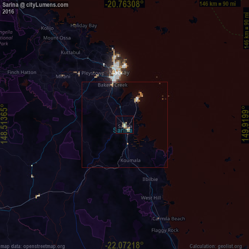
Analysis of Sarina night lights 2016
Square area 10x10 km:
 0.95%
0.95%90-99
1.33%80-89
0.76%70-79
1.52%60-69
1.52%50-59
3.03%40-49
1.89%30-39
1.89%20-29
0.76%10-19
0%0-9
86.36%Square area 50x50 km:
0.13%90-99
0.18%80-89
0.13%70-79
0.22%60-69
0.17%50-59
0.19%40-49
0.29%30-39
0.21%20-29
0.22%10-19
0.81%0-9
97.48%Clear (daylight) street map image can be seen on geolist.org.
Map coordinates:
20° 45' 47.1" South, 148° 30' 49.1" East
21° 25' 8.8" South, 149° 13' 0.4" East
22° 4' 19.8" South, 149° 55' 11.6" East
Some cities around Sarina sort by population:
• Mackay
30 km =18.6 mi,  349°
349°
• Moranbah
137.1 km =85.2 mi,  241°
241°
• Andergrove
37.5 km =23.3 mi, 354°
• South Mackay
28.8 km =17.9 mi, 351°
• West Mackay
29.9 km =18.6 mi, 349°
• Cannonvale
138 km =85.7 mi,  336°
336°
• North Mackay
33.5 km =20.8 mi, 353°
• Beaconsfield
36.8 km =22.9 mi, 351°
2150216 (p: 5,534)
Sources (retrieved 2019-11-25):
» Earth at Night: Flat Maps 2012, 2016