Moranbah night lights from space
Night Light of Moranbah (Queensland) from space (Australia) Src. Average luminocity for 10x10km area is 19.3194% and for 50x50km: 5.3371%.
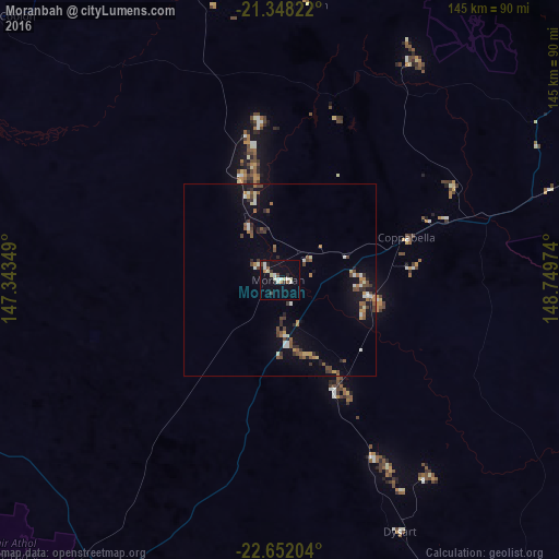
Analysis of Moranbah night lights 2016
Square area 10x10 km:
 3.17%
3.17%90-99
5.16%80-89
1.98%70-79
0%60-69
1.59%50-59
1.79%40-49
1.59%30-39
2.18%20-29
2.78%10-19
13.69%0-9
66.07%Square area 50x50 km:
0.47%90-99
0.78%80-89
0.43%70-79
0.4%60-69
0.61%50-59
0.91%40-49
1.12%30-39
0.8%20-29
0.81%10-19
3.5%0-9
90.17%Clear (daylight) street map image can be seen on geolist.org.
Map coordinates:
21° 20' 53.6" South, 147° 20' 36.6" East
22° 0' 5.9" South, 148° 2' 47.8" East
22° 39' 7.3" South, 148° 44' 59.1" East
Some cities around Moranbah sort by population:
• Mackay
149.3 km =92.8 mi,  50°
50°
• Emerald
169.5 km =105.3 mi,  176°
176°
• Andergrove
155.7 km =96.7 mi, 49°
• South Mackay
149.6 km =93 mi, 51°
• West Mackay
148.9 km =92.5 mi, 50°
• North Mackay
152.7 km =94.9 mi, 50°
• Sarina
137.1 km =85.2 mi,  61°
61°
• Beaconsfield
153.7 km =95.5 mi, 48°
6533368 (p: 12,068)
Sources (retrieved 2019-11-25):
» Earth at Night: Flat Maps 2012, 2016