Roleystone night lights from space
Night Light of Roleystone (Western Australia) from space (Australia) Src. Average luminocity for 10x10km area is 18.1119% and for 50x50km: 27.5136%.
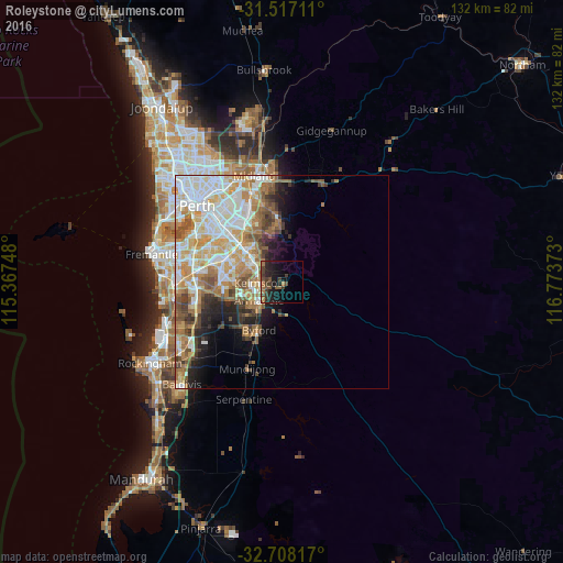
Analysis of Roleystone night lights 2016
Square area 10x10 km:
 0.35%
0.35%90-99
0.7%80-89
0.52%70-79
0.87%60-69
5.59%50-59
3.67%40-49
4.9%30-39
6.12%20-29
9.62%10-19
18.36%0-9
49.3%Square area 50x50 km:
6.24%90-99
6.53%80-89
3.16%70-79
4.25%60-69
5.06%50-59
3.54%40-49
2.55%30-39
2.71%20-29
2.93%10-19
4.98%0-9
58.04%Clear (daylight) street map image can be seen on geolist.org.
Map coordinates:
31° 31' 1.6" South, 115° 22' 2.9" East
32° 6' 52.5" South, 116° 4' 14.2" East
32° 42' 29.4" South, 116° 46' 25.4" East
Some cities around Roleystone sort by population:
• Thornlie
12.5 km =7.8 mi,  299°
299°
• Gosnells
7.2 km =4.5 mi, 301°
• Armadale
6.8 km =4.2 mi,  238°
238°
• Maddington
10.9 km =6.8 mi,  311°
311°
• Kelmscott
4.3 km =2.7 mi,  255°
255°
• Southern River
10.6 km =6.6 mi,  274°
274°
• Seville Grove
8.1 km =5 mi,  252°
252°
• Huntingdale
10.4 km =6.5 mi,  289°
289°
2062259 (p: 6,425)
Sources (retrieved 2019-11-25):
» Earth at Night: Flat Maps 2012, 2016