Gosnells night lights from space
Night Light of Gosnells (Western Australia) from space (Australia) Src. Average luminocity for 10x10km area is 56.8671% and for 50x50km: 38.3244%.
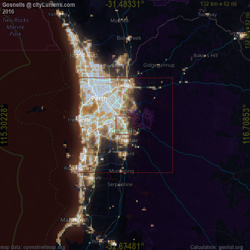
Analysis of Gosnells night lights 2016
Square area 10x10 km:
 6.47%
6.47%90-99
7.87%80-89
8.57%70-79
11.89%60-69
18.36%50-59
9.27%40-49
8.04%30-39
4.55%20-29
9.44%10-19
15.38%0-9
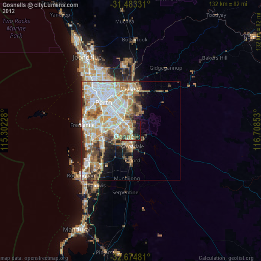
0.17%Square area 50x50 km:
8.93%90-99
9.47%80-89
4.27%70-79
5.41%60-69
7.96%50-59
4.9%40-49
3.43%30-39
3.15%20-29
4.12%10-19
5.09%0-9
43.27%Clear (daylight) street map image can be seen on geolist.org.
Map coordinates:
31° 28' 59.9" South, 115° 18' 8.2" East
32° 4' 51.6" South, 116° 0' 19.4" East
32° 40' 29.3" South, 116° 42' 30.7" East
Some cities around Gosnells sort by population:
• Thornlie
5.3 km =3.3 mi,  296°
296°
• Maddington
4 km =2.5 mi,  328°
328°
• Kelmscott
5.2 km =3.2 mi,  158°
158°
• Southern River
5.2 km =3.2 mi,  236°
236°
• Seville Grove
6.4 km =4 mi,  194°
194°
• Huntingdale
3.7 km =2.3 mi,  266°
266°
• Roleystone
7.2 km =4.5 mi,  121°
121°
• Kenwick
6.4 km =4 mi, 325°
2070571 (p: 19,914)
Sources (retrieved 2019-11-25):
» Earth at Night: Flat Maps 2012, 2016