Riverwood night lights from space
Night Light of Riverwood (New South Wales) from space (Australia) Src. Average luminocity for 10x10km area is 84.5717% and for 50x50km: 53.2882%.
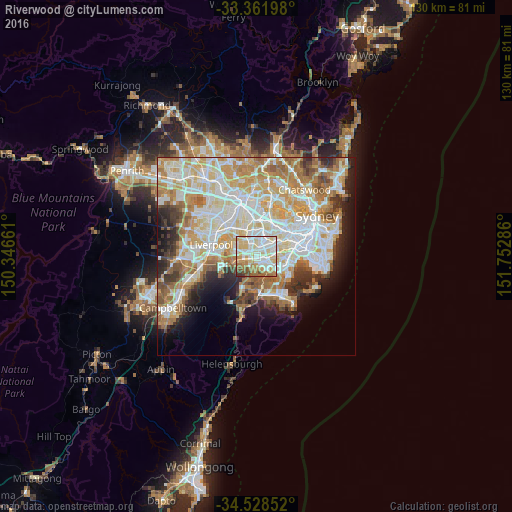
Analysis of Riverwood night lights 2016
Square area 10x10 km:
 22.2%
22.2%90-99
29.72%80-89
15.73%70-79
9.97%60-69
12.06%50-59
5.59%40-49
3.32%30-39
1.4%20-29
0%10-19
0%0-9
0%Square area 50x50 km:
13.11%90-99
14.39%80-89
7.39%70-79
8.58%60-69
8.85%50-59
4.62%40-49
3.13%30-39
4.18%20-29
4.87%10-19
6.74%0-9
24.13%Clear (daylight) street map image can be seen on geolist.org.
Map coordinates:
33° 21' 43.1" South, 150° 20' 47.8" East
33° 56' 50.1" South, 151° 2' 59" East
34° 31' 42.7" South, 151° 45' 10.3" East
Some cities around Riverwood sort by population:
• Punchbowl
2 km =1.2 mi,  3°
3°
• Revesby
3.1 km =1.9 mi,  264°
264°
• Padstow
2 km =1.2 mi,  236°
236°
• Roselands
2.7 km =1.7 mi,  54°
54°
• Peakhurst
1.7 km =1.1 mi,  174°
174°
• Wiley Park
3 km =1.9 mi,  32°
32°
• Beverly Hills
2.8 km =1.7 mi,  91°
91°
• Narwee
1.8 km =1.1 mi, 87°
2206009 (p: 12,059)
Sources (retrieved 2019-11-25):
» Earth at Night: Flat Maps 2012, 2016