Padstow night lights from space
Night Light of Padstow (New South Wales) from space (Australia) Src. Average luminocity for 10x10km area is 77.5892% and for 50x50km: 52.9303%.
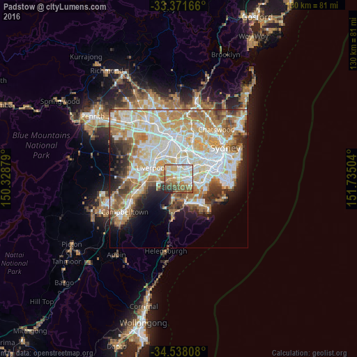
Analysis of Padstow night lights 2016
Square area 10x10 km:
 18.18%
90-99
22.55%80-89
12.41%70-79
10.49%60-69
15.03%50-59
10.14%40-49
5.24%30-39
3.15%20-29
2.8%10-19
0%0-9
0%Square area 50x50 km:
13.16%90-99
14.32%80-89
7.24%70-79
8.33%60-69
8.73%50-59
4.67%40-49
3.31%30-39
4.22%20-29
4.74%10-19
6.5%0-9
24.78%Clear (daylight) street map image can be seen on geolist.org.
Map coordinates:
33° 22' 18" South, 150° 19' 43.6" East
33° 57' 24.7" South, 151° 1' 54.9" East
34° 32' 17.1" South, 151° 44' 6.1" East
Some cities around Padstow sort by population:
• Punchbowl
3.6 km =2.2 mi,  29°
29°
• Revesby
1.6 km =1 mi,  298°
298°
• Panania
3.2 km =2 mi,  276°
276°
• Riverwood
2 km =1.2 mi,  56°
56°
• Peakhurst
1.9 km =1.2 mi,  110°
110°
• Mortdale
4 km =2.5 mi, 109°
• Narwee
3.6 km =2.2 mi,  71°
71°
• Lugarno
3 km =1.9 mi,  162°
162°
2206008 (p: 13,226)
Sources (retrieved 2019-11-25):
» Earth at Night: Flat Maps 2012, 2016