Panania night lights from space
Night Light of Panania (New South Wales) from space (Australia) Src. Average luminocity for 10x10km area is 74.0979% and for 50x50km: 53.8303%.
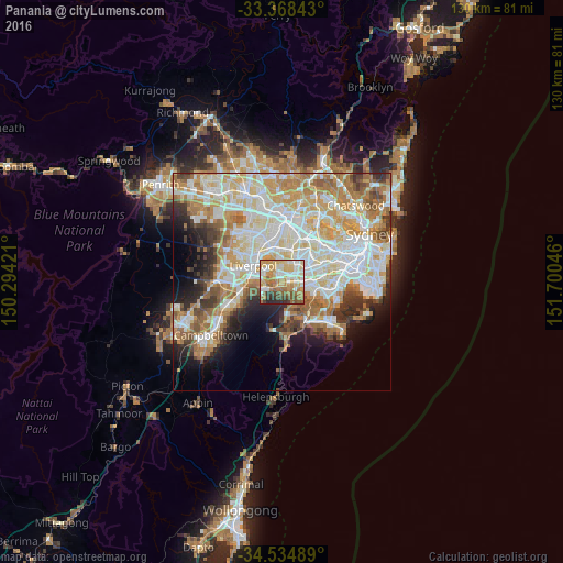
Analysis of Panania night lights 2016
Square area 10x10 km:
 12.76%
90-99
17.13%80-89
14.69%70-79
17.48%60-69
14.86%50-59
9.09%40-49
5.24%30-39
5.42%20-29
3.32%10-19
0%0-9
0%Square area 50x50 km:
13.33%90-99
14.35%80-89
7.29%70-79
8.6%60-69
9.05%50-59
4.94%40-49
3.38%30-39
4.35%20-29
4.59%10-19
6.63%0-9
23.49%Clear (daylight) street map image can be seen on geolist.org.
Map coordinates:
33° 22' 6.3" South, 150° 17' 39.2" East
33° 57' 13.2" South, 150° 59' 50.4" East
34° 32' 5.6" South, 151° 42' 1.7" East
Some cities around Panania sort by population:
• Revesby
1.8 km =1.1 mi,  77°
77°
• Padstow
3.2 km =2 mi,  96°
96°
• Riverwood
4.9 km =3 mi, 81°
• Condell Park
3.5 km =2.2 mi,  21°
21°
• Moorebank
3.9 km =2.4 mi,  286°
286°
• Wattle Grove
4.9 km =3 mi,  268°
268°
• Picnic Point
3 km =1.9 mi,  181°
181°
• Holsworthy
4.3 km =2.7 mi,  220°
220°
8348725 (p: 12,382)
Sources (retrieved 2019-11-25):
» Earth at Night: Flat Maps 2012, 2016