Norlane night lights from space
Night Light of Norlane (Victoria) from space (Australia) Src. Average luminocity for 10x10km area is 51.0114% and for 50x50km: 7.5017%.
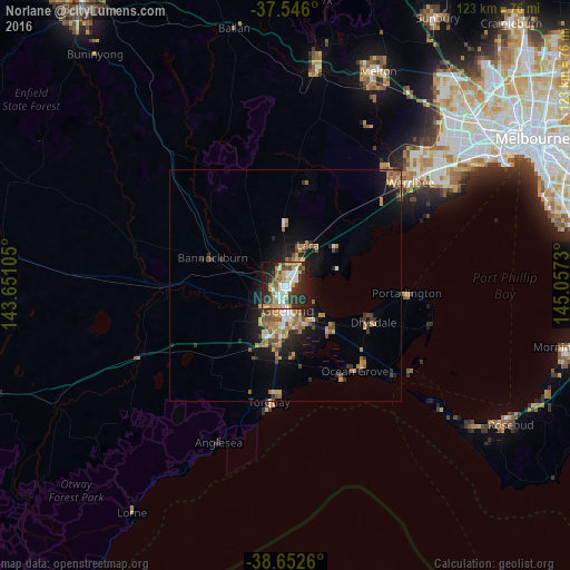
Analysis of Norlane night lights 2016
Square area 10x10 km:
 10.06%
90-99
10.55%80-89
1.79%70-79
12.18%60-69
6.17%50-59
4.38%40-49
6.33%30-39
10.88%20-29
18.51%10-19
17.37%0-9
1.79%Square area 50x50 km:
0.7%90-99
0.78%80-89
0.36%70-79
1.83%60-69
1.27%50-59
1.24%40-49
1.34%30-39
0.99%20-29
2.01%10-19
5.25%0-9
84.21%Clear (daylight) street map image can be seen on geolist.org.
Map coordinates:
37° 32' 45.6" South, 143° 39' 3.8" East
38° 6' 5" South, 144° 21' 15" East
38° 39' 9.4" South, 145° 3' 26.3" East
Some cities around Norlane sort by population:
• Geelong
5.1 km =3.2 mi,  173°
173°
• Highton
8.6 km =5.3 mi,  205°
205°
• Corio
3.2 km =2 mi,  51°
51°
• Belmont
8.2 km =5.1 mi,  186°
186°
• Newtown
6.1 km =3.8 mi,  195°
195°
• Geelong West
4.2 km =2.6 mi, 186°
• Hamlyn Heights
3.2 km =2 mi,  226°
226°
• Geelong city centre
5.4 km =3.4 mi, 172°
2207153 (p: 8,216)
Sources (retrieved 2019-11-25):
» Earth at Night: Flat Maps 2012, 2016