Geelong West night lights from space
Night Light of Geelong West (Victoria) from space (Australia) Src. Average luminocity for 10x10km area is 57.4133% and for 50x50km: 7.278%.
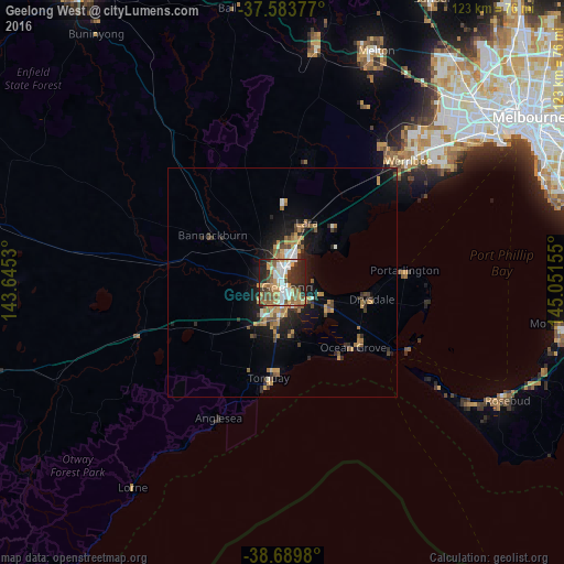
Analysis of Geelong West night lights 2016
Square area 10x10 km:
 10.2%
10.2%90-99
10.88%80-89
3.74%70-79
12.93%60-69
8.84%50-59
11.05%40-49
7.65%30-39
9.86%20-29
17.35%10-19
7.48%0-9
0%Square area 50x50 km:
0.71%90-99
0.78%80-89
0.32%70-79
1.84%60-69
1.19%50-59
1.04%40-49
1.26%30-39
1.04%20-29
2.04%10-19
5.08%0-9
84.71%Clear (daylight) street map image can be seen on geolist.org.
Map coordinates:
37° 35' 1.6" South, 143° 38' 43.1" East
38° 8' 20" South, 144° 20' 54.3" East
38° 41' 23.3" South, 145° 3' 5.6" East
Some cities around Geelong West sort by population:
• Highton
4.8 km =3 mi,  222°
222°
• Corio
6.9 km =4.3 mi,  26°
26°
• Grovedale
6.8 km =4.2 mi,  178°
178°
• Belmont
4 km =2.5 mi,  187°
187°
• Newtown
2 km =1.2 mi,  214°
214°
• Norlane
4.2 km =2.6 mi,  6°
6°
• Hamlyn Heights
2.7 km =1.7 mi,  317°
317°
• Waurn Ponds
10.4 km =6.5 mi, 213°
2165796 (p: 6,775)
Sources (retrieved 2019-11-25):
» Earth at Night: Flat Maps 2012, 2016