Belmont night lights from space
Night Light of Belmont (Victoria) from space (Australia) Src. Average luminocity for 10x10km area is 57.0136% and for 50x50km: 7.1482%.
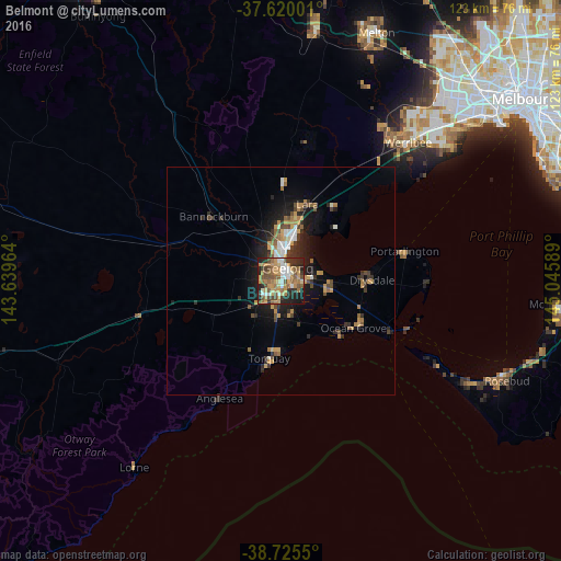
Analysis of Belmont night lights 2016
Square area 10x10 km:
 7.65%
7.65%90-99
6.8%80-89
5.61%70-79
15.65%60-69
12.59%50-59
11.73%40-49
11.05%30-39
6.46%20-29
14.63%10-19
7.82%0-9
0%Square area 50x50 km:
0.71%90-99
0.78%80-89
0.32%70-79
1.78%60-69
1.19%50-59
1.04%40-49
1.23%30-39
1.04%20-29
2%10-19
4.8%0-9
85.11%Clear (daylight) street map image can be seen on geolist.org.
Map coordinates:
37° 37' 12" South, 143° 38' 22.7" East
38° 10' 29.5" South, 144° 20' 33.9" East
38° 43' 31.8" South, 145° 2' 45.2" East
Some cities around Belmont sort by population:
• Geelong
3.5 km =2.2 mi,  26°
26°
• Highton
2.8 km =1.7 mi,  279°
279°
• Grovedale
2.9 km =1.8 mi,  167°
167°
• Newtown
2.4 km =1.5 mi,  343°
343°
• Geelong West
4 km =2.5 mi,  7°
7°
• Hamlyn Heights
6.1 km =3.8 mi,  347°
347°
• Geelong city centre
3.2 km =2 mi, 30°
• Waurn Ponds
7 km =4.3 mi,  228°
228°
2176262 (p: 13,767)
Sources (retrieved 2019-11-25):
» Earth at Night: Flat Maps 2012, 2016