Nedlands night lights from space
Night Light of Nedlands (Western Australia) from space (Australia) Src. Average luminocity for 10x10km area is 78.1923% and for 50x50km: 42.2175%.
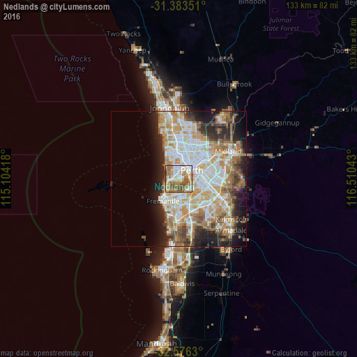
Analysis of Nedlands night lights 2016
Square area 10x10 km:
 19.41%
90-99
17.66%80-89
10.84%70-79
12.94%60-69
23.6%50-59
8.57%40-49
6.99%30-39
0%20-29
0%10-19
0%0-9
0%Square area 50x50 km:
9.32%90-99
10.21%80-89
4.98%70-79
6.65%60-69
8.13%50-59
4.75%40-49
3.46%30-39
3.7%20-29
6.84%10-19
8.25%0-9
33.7%Clear (daylight) street map image can be seen on geolist.org.
Map coordinates:
31° 23' 0.6" South, 115° 6' 15" East
31° 58' 54.6" South, 115° 48' 26.3" East
32° 34' 34.7" South, 116° 30' 37.5" East
Some cities around Nedlands sort by population:
• Subiaco
4.1 km =2.5 mi,  26°
26°
• Mosman Park
4.9 km =3 mi,  237°
237°
• Claremont
2.4 km =1.5 mi,  276°
276°
• Floreat
5 km =3.1 mi,  343°
343°
• Cottesloe
4.8 km =3 mi,  253°
253°
• Applecross
4.6 km =2.9 mi,  147°
147°
• Attadale
4.8 km =3 mi,  185°
185°
• West Perth
4.9 km =3 mi,  41°
41°
2064874 (p: 10,949)
Sources (retrieved 2019-11-25):
» Earth at Night: Flat Maps 2012, 2016