Mount Waverley night lights from space
Night Light of Mount Waverley (Victoria) from space (Australia) Src. Average luminocity for 10x10km area is 84.8506% and for 50x50km: 50.9101%.
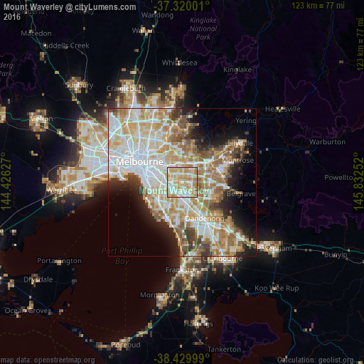

Analysis of Mount Waverley night lights 2016
Square area 10x10 km:
 18.51%
90-99
24.19%80-89
18.02%70-79
26.46%60-69
12.66%50-59
0.16%40-49
0%30-39
0%20-29
0%10-19
0%0-9
0%Square area 50x50 km:
13.04%90-99
12.21%80-89
6.37%70-79
8.92%60-69
7.9%50-59
5.92%40-49
3.95%30-39
3.66%20-29
4.83%10-19
7.45%0-9
25.76%Clear (daylight) street map image can be seen on geolist.org.
Map coordinates:
37° 19' 12" South, 144° 25' 34.6" East
37° 52' 37.5" South, 145° 7' 45.8" East
38° 25' 48" South, 145° 49' 57.1" East
Some cities around Mount Waverley sort by population:
• Glen Waverley
3.1 km =1.9 mi,  92°
92°
• Burwood
3.2 km =2 mi,  343°
343°
• Burwood East
3.5 km =2.2 mi,  30°
30°
• Chadstone
3.2 km =2 mi,  248°
248°
• Oakleigh
4.3 km =2.7 mi,  237°
237°
• Ashburton
4.2 km =2.6 mi,  285°
285°
• Ashwood
2.4 km =1.5 mi,  299°
299°
• Oakleigh East
2.8 km =1.7 mi,  203°
203°
2156492 (p: 33,149)
Sources (retrieved 2019-11-25):
» Earth at Night: Flat Maps 2012, 2016