Burwood night lights from space
Night Light of Burwood (Victoria) from space (Australia) Src. Average luminocity for 10x10km area is 84.0471% and for 50x50km: 51.6591%.
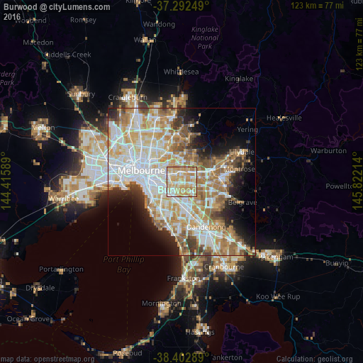
Analysis of Burwood night lights 2016
Square area 10x10 km:
 15.75%
90-99
21.75%80-89
21.59%70-79
29.55%60-69
11.04%50-59
0.32%40-49
0%30-39
0%20-29
0%10-19
0%0-9
0%Square area 50x50 km:
13.3%90-99
12.51%80-89
6.41%70-79
9.08%60-69
8.07%50-59
5.96%40-49
3.92%30-39
3.35%20-29
5.06%10-19
7.23%0-9
25.1%Clear (daylight) street map image can be seen on geolist.org.
Map coordinates:
37° 17' 33" South, 144° 24' 57.2" East
37° 50' 59.2" South, 145° 7' 8.4" East
38° 24' 10.4" South, 145° 49' 19.7" East
Some cities around Burwood sort by population:
• Mount Waverley
3.2 km =2 mi,  163°
163°
• Surrey Hills
4 km =2.5 mi,  335°
335°
• Box Hill
3.5 km =2.2 mi,  9°
9°
• Blackburn South
3.4 km =2.1 mi,  70°
70°
• Box Hill South
1.9 km =1.2 mi, 5°
• Canterbury
4.1 km =2.5 mi,  312°
312°
• Ashburton
3.7 km =2.3 mi,  239°
239°
• Ashwood
2.2 km =1.4 mi,  212°
212°
7932622 (p: 14,898)
Sources (retrieved 2019-11-25):
» Earth at Night: Flat Maps 2012, 2016