Melbourne City Centre night lights from space
Night Light of Melbourne City Centre (Victoria) from space (Australia) Src. Average luminocity for 10x10km area is 97.0782% and for 50x50km: 55.532%.
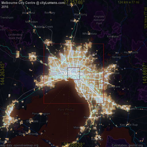
Analysis of Melbourne City Centre night lights 2016
Square area 10x10 km:
 74.15%
90-99
19.05%80-89
1.7%70-79
0.85%60-69
0%50-59
2.89%40-49
1.36%30-39
0%20-29
0%10-19
0%0-9
0%Square area 50x50 km:
15.54%90-99
14.23%80-89
7.04%70-79
9.44%60-69
7.6%50-59
4.74%40-49
3.49%30-39
3.62%20-29
5.9%10-19
7.63%0-9
20.78%Clear (daylight) street map image can be seen on geolist.org.
Map coordinates:
37° 15' 26.9" South, 144° 15' 48.4" East
37° 48' 54" South, 144° 57' 59.7" East
38° 22' 6.2" South, 145° 40' 10.9" East
Some cities around Melbourne City Centre sort by population:
• Southbank
0.9 km =0.6 mi,  192°
192°
• Carlton
1.7 km =1.1 mi,  0°
0°
• Docklands
1.4 km =0.9 mi,  270°
270°
• Fitzroy
2.1 km =1.3 mi,  29°
29°
• South Melbourne
2 km =1.2 mi,  179°
179°
• Collingwood
2.4 km =1.5 mi,  54°
54°
• East Melbourne
1.9 km =1.2 mi,  95°
95°
• West Melbourne
1.6 km =1 mi,  290°
290°
11523810 (p: 60,057)
Sources (retrieved 2019-11-25):
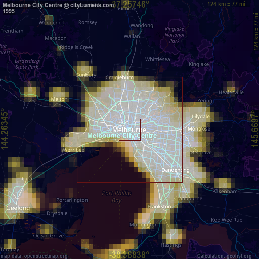
» NASA, Earths city lights 1995
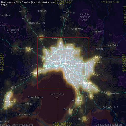
» NASA city lights 2003
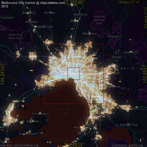
» Earth at Night: Flat Maps 2012, 2016